Thursday 5th October
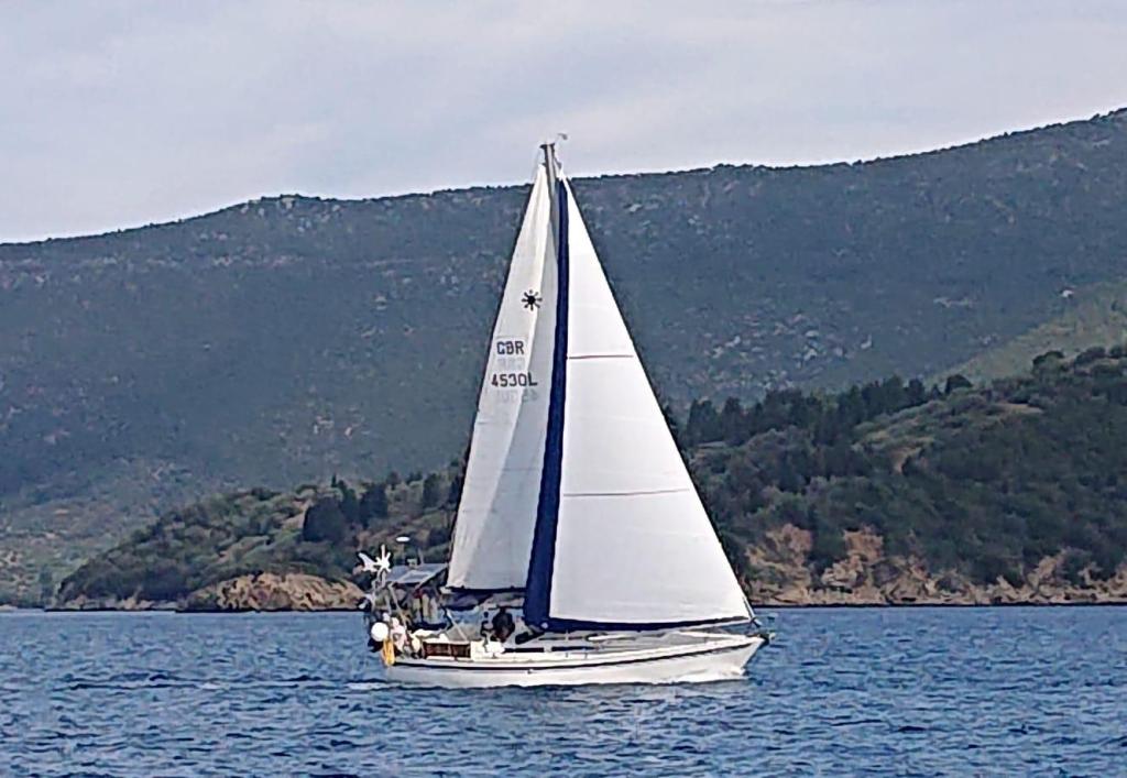
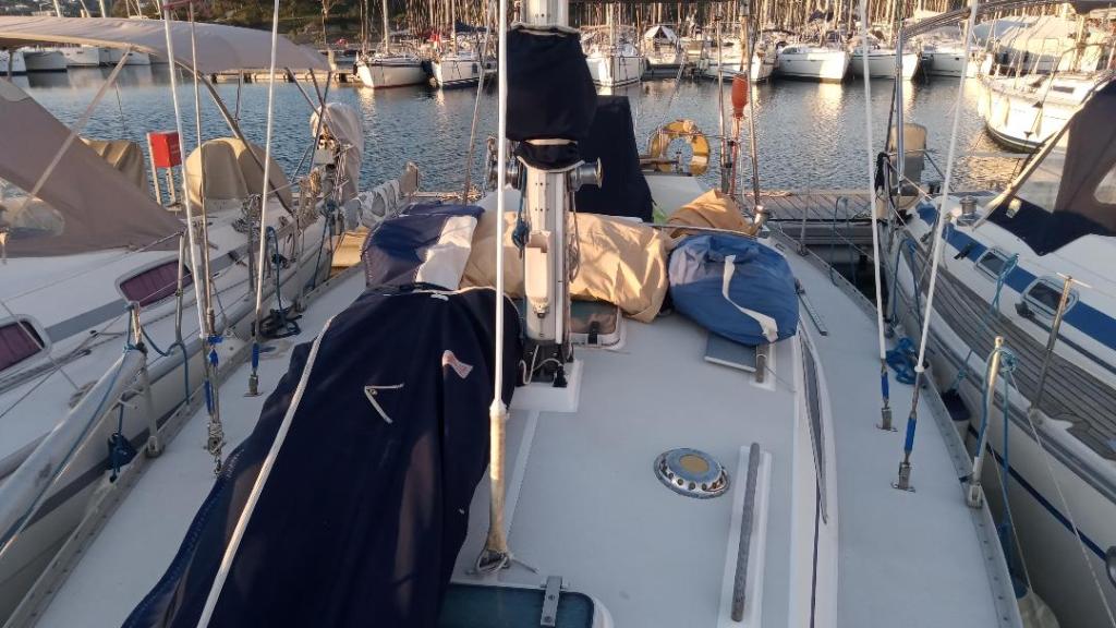
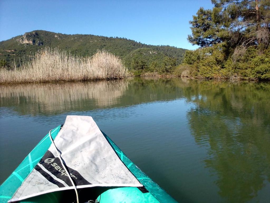
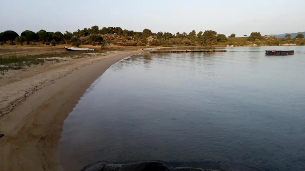
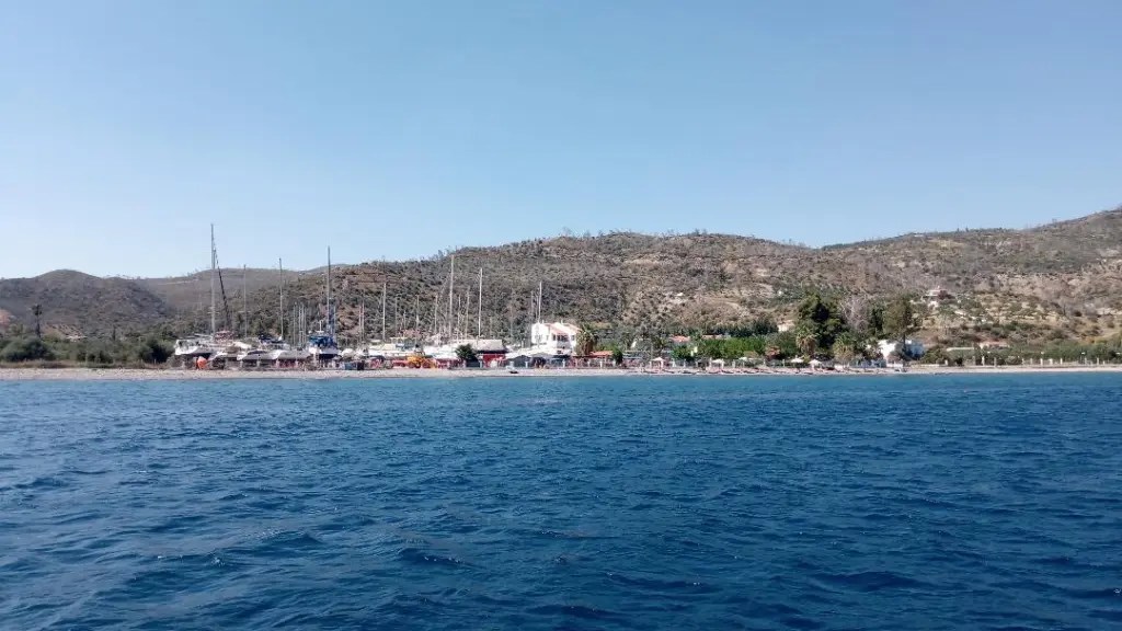
I left the anchorage at Plytra at 1030 after the forecast had updated on PredictWind. It was now looking like the N winds in the Aegean would be less than previously predicted. On the way down the coast to Elafonisos island the wind was from SW until about half way when it changed through 180 in a matter of seconds. It was then close hauled through the straights between Kythira and Cap Maleas, the third and final toe, which I cleared about a mile off at 1600. I had 2 reefs in at this stage with gusts of around 20kts and a big sea to contend with, but SO took it all in her stride and bounced along. There is no TSS through the straights so ships were coming down from north and turning west as it suited them. I was trying to cross their path heading east so difficult to predict their route. Initially my best heading was due E and with significant leeway I was tracking 30 degrees below Mylos but speed was good at over 5kts so I ploughed on. Just before darkness fell I let out both reefs. The wind had eased and started to back and the sea moderated, so my heading improved and by middle of the night I was recovering lost ground. It was a warm night at 23c and there was a big bright moon which rose directly over my destination. I hand steered for hours as the autoplilot struggled to hold a steady enough heading when close hauled in a sea, and a couple of times it almost put me into a tack. Ships continued to cross my path in all directions so the AIS alarm was regularly going off and keeping me on my toes. I had hot chocolate, nuts and raisins to sustain me. By 0400 I was just 12 miles off Mylos and closing fast, I was going to arrive too early when still dark !! So I slowed down by rolling up some of the genoa and was able to time my approach into Ormos Milou bay just as the sky brightened. The bay is the middle of an old caldera, similar to Santorini, and the main town Adhamas is tucked into a corner with a wide shallow sandy bay. I dropped the hook just as the sun rose behind the hills, and probably woke the other nearby boats with the clatter of chain.
Monday 9th October
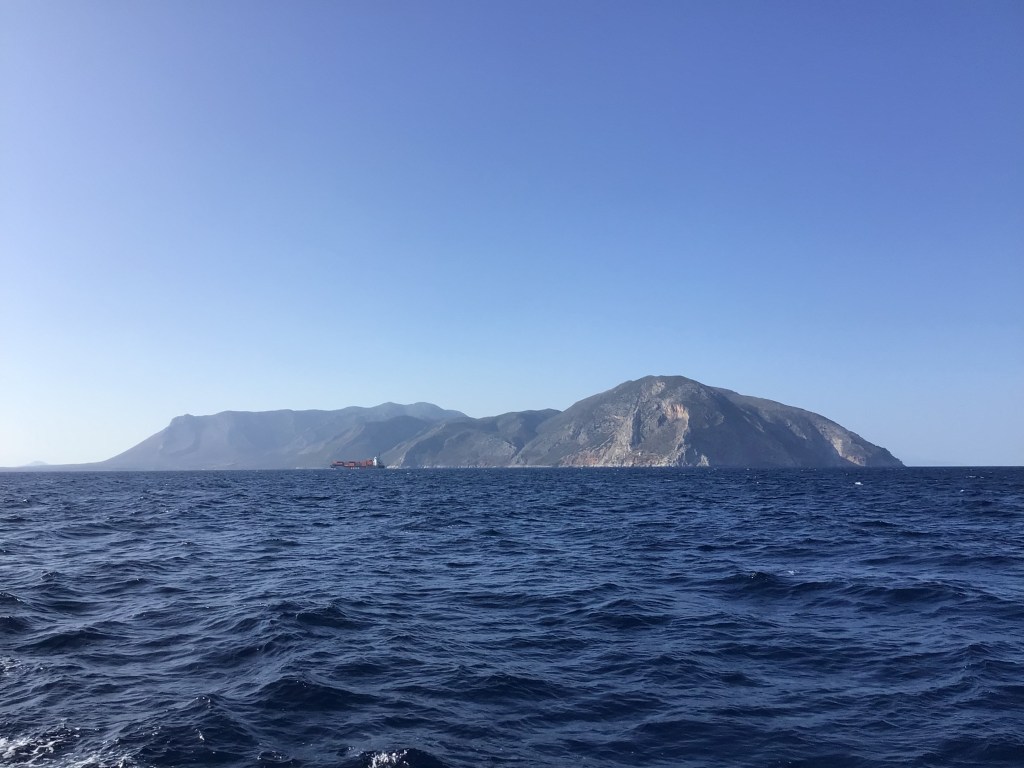
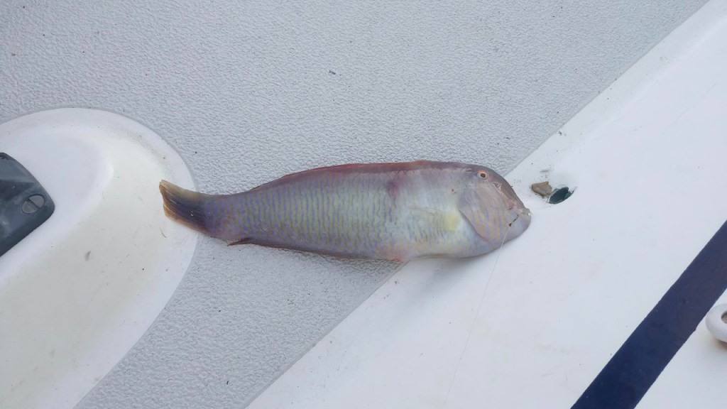
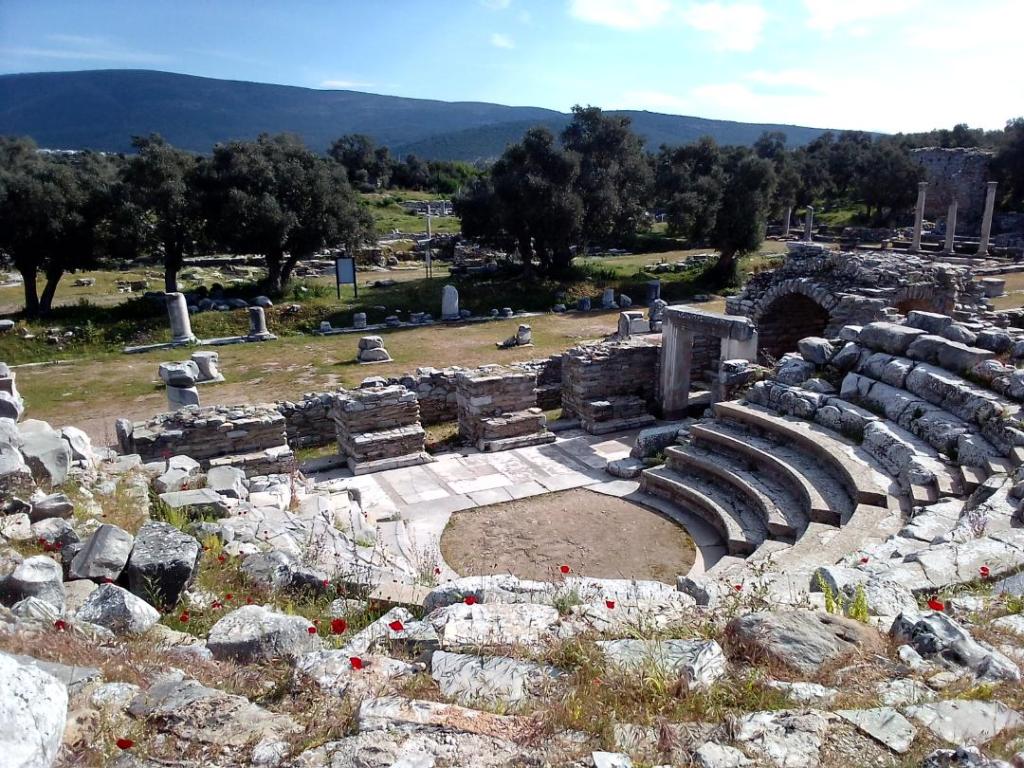
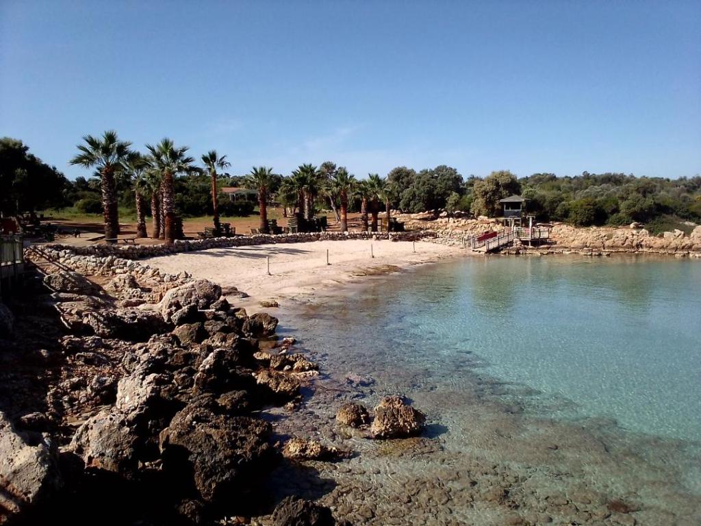
Milos has had a colourful history, since ancient times a source of many types of minerals that were traded all over the Med. Today there are some ugly open cast mines but there are also cliffs which are a patchwork of colours and dramatic rock formations. It is the place where the iconic statue of Aphrodite was discovered. A replica stands close to the spot on a steep hillside overlooking the caldera. In WW2 it was a key German stronghold, very heavily fortified and almost the last place to surrender. After a night at anchor I went onto the harbour pontoon to sit out 48 hours of strong meltemi winds. Just €17 for two nights including water. Yesterday I set off unsure whether to go left or right out of the caldera so waited till outside to see which way the wind was blowing. A NW wind resulted in me going right, East, just a few miles, to an area with many small islands and a multitude of possible anchorages. I spent the night on the south side of Kimolos, in a wide sandy bay, with not another soul. Today’s forecast was for 15 to 20kts N so I continued to journey East toward Folegandros, on a lively beam reach, under just genoa. There are few sheltered anchorages on the island but the one at Vathi, on the south coast, is very good even though prone to gusts. Headline news, I actually caught a fish ! after years of trying. According to my fish identification app it is a Pearly Razorfish, just 8 inches long, and as such is sadly not going to make a dinner. So it’s going to have to be rehydrated beans and rice again tonight.

the armless Aphrodite
The evidence
Wednesday 11th October
Yesterday it was a wild ride from Folegandros to Santorini a distance of almost 30nm south east. The wind came from NW and increased during the day to 22kts. The genoa alone was quite sufficient and with the pole on kept the boat stable in an increasingly big and confused sea. Santorini, or Thyra as it was known in ancient times, is famous for having blown its top some 3600 years ago, believed to be one of the largest eruptions the world had seen in human history. The caldera is about 5 miles in diameter, so the amount of material thrown into the atmosphere was so huge it is hard to imagine. The caldera has two openings from the sea and there is an island in the centre. However there is nowhere inside the caldera that a private boat can anchor or moor. The depths fall away too rapidly to anchor, or moorings have been laid by the tour boats, for their use, wherever there is any bottom at all, and anchoring is not allowed. There is one marina on the south side but that is almost entirely occupied by fleets of catamarans operated as trip boats. Private boats are apparently not welcome. Which means there is just the one anchorage that is sheltered from meltemi, near the ancient Minoan settlement of Akroteri on the south side. So I headed straight there and anchored just a 100m off the beach in 4m on sand. It is crowded as today we have had 30kt gusts and this is the only sheltered place. The catamaran trip boats have trouped past though, going from the marina round into the caldera, literally dozens of them. Winds are lighter over next few days and Hester arrives on Saturday so hopefully we will then sail into the caldera and take some photos.
Tuesday 17th October
After a few days and nights on the anchorage at Akrotiri we raised the hook on Sunday and set off to pass through the caldera. The night before we were kept awake till 4.30 am by a live band playing traditional greek music at the nearby hotel. It just went on and on and on !! We motored through the caldera to take the iconic photos of Oia and Fira perched on top of the cliffs as if about to topple off. I had an AIS alert for a fast cat just leaving the ferry port, about 2nm away, but then he altered course away from me in order to clear the end of the island in the centre of the caldera, so AIS removed him as a target. I went down below to get something, away no longer than a minute, and when I came back up I see this monster aiming directly at us again, about half a mile away now and doing 20kts plus. I’m a sitting duck ! He past behind us no more than 5 boat lengths away blasting his hooter. We then sailed due north in 10kts on a broad reach to the island of Ios and the delightfully peaceful Manganari bay at the southern end. Last night we had 25kts + in the anchorage, partly katabatic, but the anchor held firm in the sand on 55m of chain. We waited till mid morning for it to calm down some before setting off west aiming initially for Folegandros. With 16 kts on the beam we tore across to the island of Sikinos and then along its south coast. The forecast for the night is tricky as there will be winds over 25kts from SW in the early hours, the usual anchorages sheltered from the northerly meltemi will be untenable. So we carry on along the north side of Folegandros to Polyaigos where there is one bay that is sheltered from north and their is a tiny islet providing also some shelter from SW. We arrive just as the sun is going down so Hester is able to capture some great shots of the cliffs with all their colours.

Manganari bay, Ios
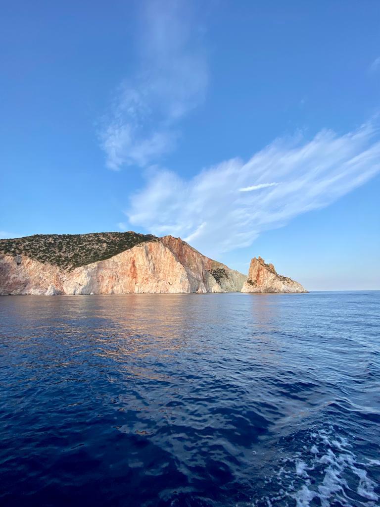
Polyaigos
Tuesday 24th October
On Friday in Milos it got very choppy on the pontoon as the wind came from SE giving a two mile fetch across the caldera. The lines were snatching frequently and when the ferry came in it caused such a wash that our gang plank was broken.

On Saturday we sailed back out again with a SE 8kts and around the north side to anchor off Sarakiniko. Here there are amazing rock formations, created by wind and rain, and looking for all the world like snow drifts or glaciers. We took the kayak ashore and paddled up a creek between the rocks. While having a swim I was bitten by a fish, it drew blood! Later that day we sailed on east, back to the anchorage on Polyaigos.

Sarakiniko
On Sunday there was no wind to speak of so motored the 15nm to Folegandros, to Vathi Bay the anchorage on the south west side where I stopped about 10 days ago. Now the place has almost closed down for the winter, the season seems to end abruptly the second week of October. I laid out a kedge anchor which again worked well minimising rolling through the windless night.
Yesterday was again a flat calm but we have to get back to Santorini for Hester’s flight home so it was 6 hours of motoring back to the anchorage at Akrotiri.
Friday 27th October
On Wednesday I left the anchorage at Akrotiri as winds were coming round to south so it would be exposed.. I passed through the caldera to Riva bay on the northern side of Thirasia island. Here there are mooring buoys used by the trip boats who all clear off after the sunset. However the sky was completely overcast, such a contrast to the evening before when Hester and I went to Oia and saw a perfect sunset. Despite this the trip boats still all turned out but there was nothing to see ! I picked up one of the large red mooring buoys which was endowed with a long line making it easy to pick up.
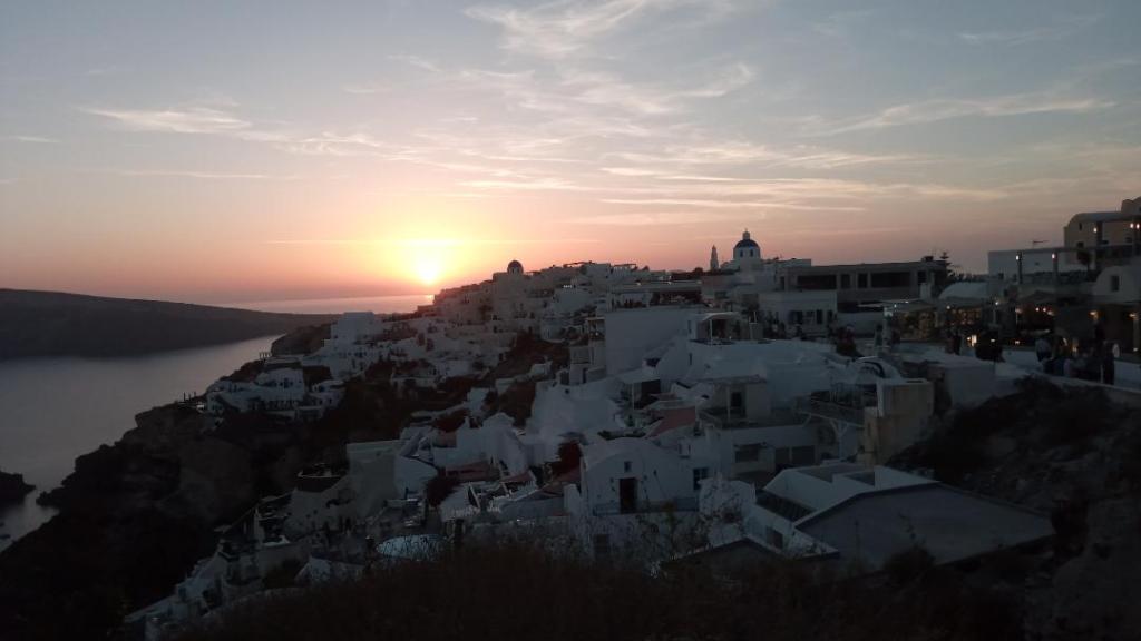
Sunset over Oia, Santorini
On Thursday I set sail for Ios but soon had to resort to motoring again. Winds are consistently at the bottom end of ranges. The sky was heavily overcast but delivered only light rain. I travelled up the eastern side of Ios, passing a couple of good anchorages but in the night the wind would be picking up and going SE, so they would likely be uncomfortable. On the north eastern side I went into Theodhotis bay, a wide sandy bay that once had a fair bit of tourism it seemed but now all abondonned and derelict. I wonder if the success of Santorini has left the nearby islands, which are mostly barren rock, struggling to attract visitors.
Theodhotis Bay, Ios
Today I sailed east in a fine breeze of 12 kts SE. It was just 10nm round to the eastern end of Irakleia and Livadi bay. There are undersea power and communication cables running out of the bay to other islands, lying on the sea bed and hardly buried, so I am careful where to drop the hook.
Monday 30th October
Saturday I departed Irakleia with the promise of 12 to 15 kts SW but yet again this proved to be complete nonsense until early afternoon. Until then I had less than 4 kts mostly from N, compounded by a lumpy sea which prevented the sails holding any wind at all. I passed through some small rocky and barren islets where there was a surprising current running. By late afternoon I was tearing along at 7 kts on a broad reach and closing fast on Amorgos island. The anchorage on the north side looked like it might be a bad choice but reports had suggested it would provide good all round shelter and this indeed proved to be the case. The final approach around a dog leg and it was all peace and calm in the bay at Kalotyri.
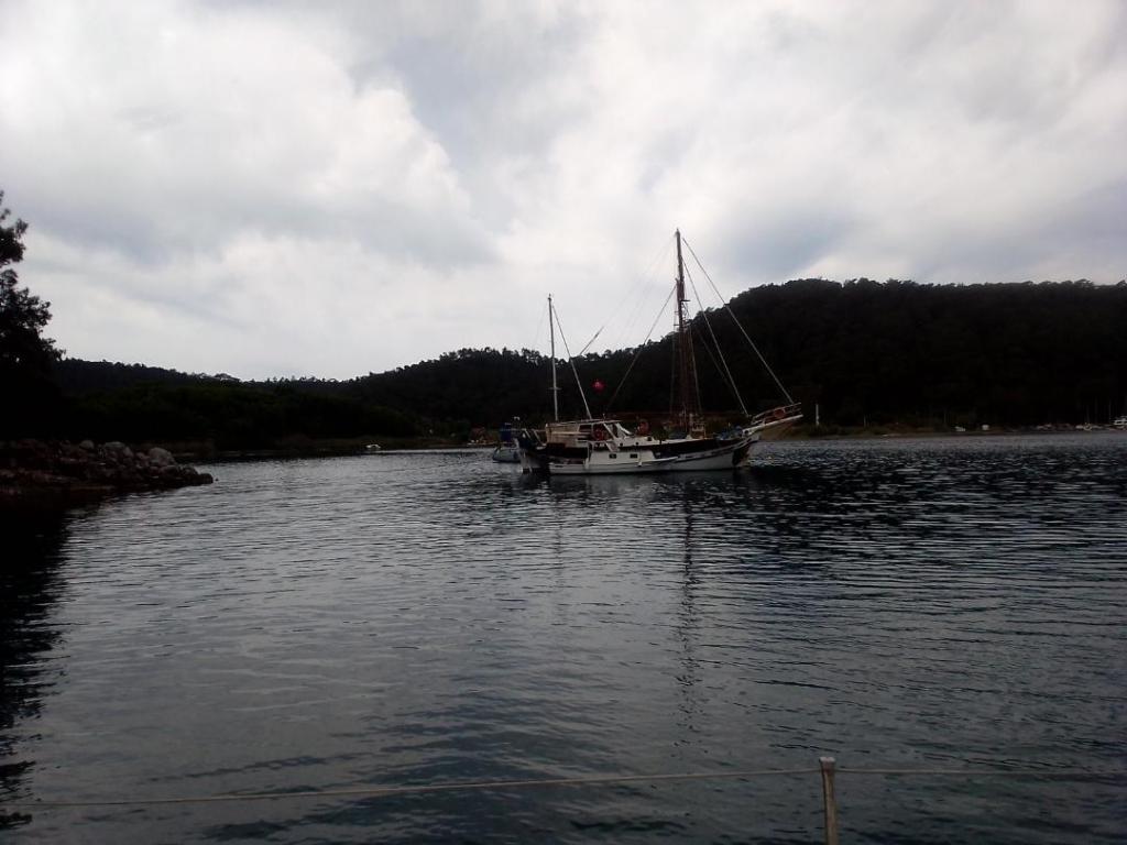
Sunday and of course the clocks had gone back so I took advantage of the earlier sunrise. To exit the anchorage at the eastern end I had to navigate a very narrow and shallow channel. It was downwind so I had the engine running just in case I needed to back out in a hurry but depths remained no less than 5m. I was crossing from Amorgos to Levitha island and soon discovered that the gap is on the main shipping route between Suez and the Black Sea. There are ships going either north or south about every 20 minutes. on the south side of Levitha there is an anvil shaped bay with an anchorage at the head of each arm. The right hand one is cluttered with mooring buoys and some fishing boats so I go for the left hand one and drop anchor dead centre. There are no boats, no people, not even a goat. When the full moon rises it shines brightly, reflecting on the water across the bay, and there is just the sound of water lapping on the rocks, not a breath of wind. Pure nature.
This morning I weighed anchor at dawn and headed out on the last passage this season, destination the island of Leros 20nm east. The wind having gone round to north provides a fine close reach in 10kts, SO romping along. I threaded through three small fishing boats, each going round in circles, which is what they do. They drop one end of a net with a float then go round in a circle feeding out the net, like a curtain, till they get back to the float, then pull a draw string at the bottom of the net, and bag themselves a bunch of fish, hopefully. Tonight I am in Xirokampos bay at the southern end of Leros and will go in the marina tomorrow.
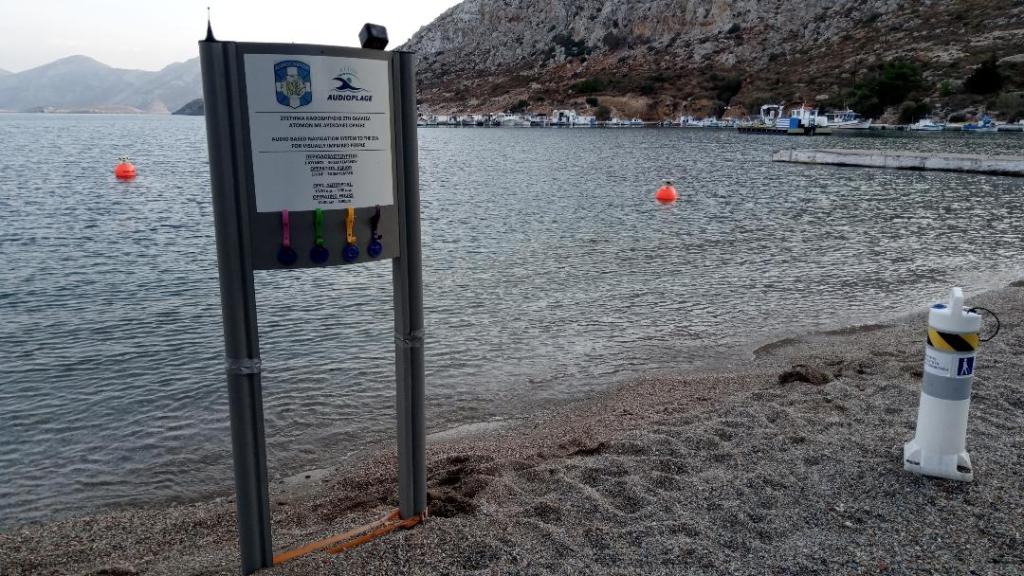
The sign says it’s an audio guided bathing area, for the visually impaired.
18th March 2024
My return to Greece was marked by a bad omen. The small plane from Athens descended toward Leros into a thunderstorm, lurching and bucking, I could see breaking seas below and lightening above. Then the pilot announced that wind speeds were too high for safe landing and he was flying back to Athens ! A couple of hours later we did return again, this time Leros was bathed in sunshine and surrounded by calm seas. Lest one should forget, it was a timely reminder of how quickly and severely conditions can change in the islands of the Aegean.
Sea Orchid I can happily report is in pretty good shape. Winter storm damage is limited to the gang plank, the large stern fender, and the sun awnings which are trashed. The bilges are bone dry. The jobs list is short, make some alterations to the diesel heater installation, and service the engine. Plus of course refitting sails, safety lines and equipment. It’s a pleasant 20c in the day, a cool 14c at night. Just a few other folks about, a French couple and a Canadian couple on my pontoon, recently returned and prepping their boats.
Re-stocking the larder has commenced, back on the menu are fresh fish, spinach pie and apricot tart.
Tuesday 26th March
Between bouts of strong winds, often over 30kts, I’ve managed re-rig the sails and refit all the canvas items on deck. The engine has been serviced, the steering cables greased and tightened, and the mast inner shrouds tightened half a turn each side. I fitted a new fuel line to the diesel heater and this has cured the air bubbles so it runs as it should now. But I have not been able to get a good seal on the exhaust joint where I fitted a new section to the old where it had rusted away. Consequently exhaust emissions are leaking into the stern locker, where the air intake is, thus rendering use of the heater still a no no, for fear of CO getting in the cabin. But it is warming up a bit now, 18c last night.
So all ready to set sail. Tomorrow I will go to Customs to retrieve my Transit Log, I can’t go anywhere without that, but they will only let me have it if I can prove I’ve paid my ETEPAI, tourist tax. Apparently there have been problems with this working in their system, so even if I can show the transaction on my bank account, this is not good enough for the authorities here.
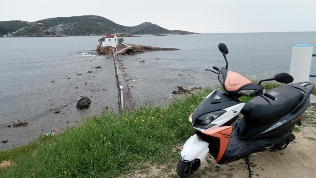
In between jobs I have managed to explore some of Leros. It’s only a small island, about 7 miles by 2 miles, deeply indented by bays and hilly rather than mountainous. There is very little development and retains the charm of a laid back Greek island of yesteryear. There are cafes and bakeries dotted all over, serving locals not tourists at this time of year. You hear the sound of goat bells on every hillside, and see cats and chickens in abundance. I rented an electric scooter today, it has been ideal to get around on, with plenty of poke to get up the hills and used only half a charge covering most of the island.
In one of the pictures below you can see the marina on the left side of the bay and the refugee camp on the right. Every day I see folk walking past on their way to and from the town, and one can’t help feel uncomfortable about their plight versus all of us with boats and able to sail away.
Saturday 30th March
Yesterday I left the Marina on a still and sunny morning that foretold of a hot day to come. The day before I had topped up the diesel from a small tanker that comes down from a nearby garage and plugs into a marina hose that is then run down to the end of the pontoon. At about £1.70 a litre not the cheapest but of course it took a lot of getting to a small island. Hopefully I won’t need any more till late summer in Turkey.
The not so good news is that when I went to Customs to retrieve my Transit Log they said I can stay in Greece, as captain of my ship, only until 5th May ! Apparently there is a rule that in a rolling 12 months you have a maximum 6 months afloat and although the clock was stopped when I handed in the Log, they counted the 5 months previous to November, ie since I checked into Corfu in June. This despite the fact my passport clearly shows I was not in Greece for 2 months in summer. This rule is not something I have found in any of the online reference sites and when I challenged the official I was simply told that I should know all the rules, and they were not obliged to point me at a reference. This is a good example of why so many cruisers I meet say they operate under the radar, no Transit Log and never visit Customs or Port Police.
So the plan is now being re-jigged to meld optimally this rule with the 3 month Schengen rule, as well as Turkish rules of course. I think I would have preferred the old days of free movement and taken my chances with Barbary corsairs. Meanwhile I pottered over to the town and anchored off for a few hours before having a short shake down sail up the gulf to a quiet anchorage in a small bay. Power from the prop was somewhat degraded by growth over the winter so I took the first dip of the season to scrape the worst off. It was warmer than Milford Haven at Easter a few years ago !
The photo below is of Ormos Lakki the bottom of which is strewn with wrecks, both aircraft and ships, from the battle of Leros in late 1943. The British had taken over the island from the Italians after they agreed a truce with Allies. The bay is one of the best natural harbours in the Aegean and the Italians had made it their main naval base. You can see remnants of this along the shore, and the refugee camp above. After a long battle the Germans finally re-took the island and thousands of British and Italians were taken prisoner.
Tuesday 2nd April
Now in Turkey. I arrived today from the island of Patmos. Why Patmos you may ask, well when I went back to Leros Port Police to check out of Greece I was told I could not, because although it is an official port of entry, it is only for the summer, from end of April, so I would have to go to the Customs on Patmos to clear out. aargh !
Due to the need to be out of Greece by early May I have had to re-gig the plan for the year. I will now cruise Turkey for the next two months before returning to Greece, unencumbered by the 6 month rule restriction.
Before leaving Leros I met up with Duncan and Dianne, just back on board their boat from New Zealand, and we compared notes on places to go this year. I will hopefully rendezvous with them in June and sail the northern Aegean.
Winds remained generally very light yesterday but from NE enabling me to make reasonable speed on a close reach to Patmos. I anchored in Tokyma Bay just outside the port of Skala. This morning I motored round to the port quay, where there is a small cruise ship terminal, and dozens of inter island ferries and trip boats. Further along is a strip of quay for visitors and I was able to tie up alongside, as opposed to stern to, as there was only one other boat there. A short walk to the Port Police was then followed by a number of shuttles between them and Customs to get papers and passport stamped and handed in the Transit Log. Then it was straight off due east to Turkey, a distance of 35 miles. I had to negotiate a few small islets on the way and would have enjoyed a night stop on Lipsi but Customs had emphasised that I must leave Greek waters today. Wind was light and this time abaft the beam most of the time so under sail I could only make 2 kts. Motor sailing on very low revs and keeping some pressure on the sails worked well, averaging 4.5 kts. The vhf was frequently alive with calls from Greek navy to Turkish fishing boats, and vice versa, warning them they had strayed into the other’s territorial waters. Clearly still no love lost between them. As I crossed an invisible line in my path, but clearly marked on the chart, I changed courtesy flags. Just 6 miles further on I arrived at Didim and anchored in the bay just outside the marina, taking care to avoid some no anchoring zones where there are apparently dumped explosives. Tomorrow I will dinghy into the marina and engage an agent to undertake the formalities of clearing into Turkey, fingers crossed no issues.
Thursday 4th April
Didim marina is simply awesome, it is regarded as the biggest and best in Turkey and indeed one of the most impressive in the whole Mediterranean. I have not seen better. It is stuffed with super-yachts, think Monte Carlo and you get the idea. Yesterday morning I scuttled into a corner with the dinghy and went to reception to enquire about an agent. Despite the grandeur of it all and considering I wasn’t a resident of their marina, the staff in their pressed uniforms were very obliging and of course spoke excellent English. I was directed to an Agent’s office where the whole clearing in process was handled for me, for a fee of course. There was an additional task for me which was to return to reception for a Blue Card, not actually a card or even blue, but a form which I must show at a pumping station for emptying the holding tank, no more than every 14 days. Next priority was to get a local SIM card so I took the bus up into the city, the ancient town of Didyma. There are minibuses which take about 20 people max and stop pretty much wherever you flag them down, a bit like Egypt but these are new vehicles. They run from just outside the marina every 10 minutes. Unfortunately at the Turkcell shop I was told I could not get a SIM and must return the following day because they have to link it to my Customs entry record and this does not process on the system till overnight. So today I returned and all was well. After a quick supermarket shop it was back to the boat and set off along the coast a few miles. The regular wind pattern here seems to be that it slowly picks up from W to NW through the morning to a brisk F4 for the afternoon before fading by nightfall. So I sailed downwind, further along the Gulluk Korfezi gulf and into Kuruerik Baku bay. It’s low lying land and the waters are shallow and mostly a sandy bottom. I’ve anchored off Talianaki, in a shallow lagoon which would be perfect if it were not for their building of a new resort. Almost the entire coastline of this gulf seems to be lined with hotels and resorts, so not particularly attractive.

Sunday 7th April
The meltimi, the prevailing wind from NE through NW across the Aegean, and famous in antiquity for its sometimes ferocity, is starting to build after a few days of light variable winds. Along the coast here it bends around the west facing headlands and up the gulfs, gradually losing strength towards the head. It also seems to be lightest early morning, increasing to a peak early evening, before reducing again overnight. So I’ve been moving from one gulf to another, around headlands, in the mornings, and sailing up the gulfs seeking a sheltered bay. There is a profusion of fish farms on an industrial scale, the detritus of which is sadly littering the shorelines. Some bays have attracted the attention of hotel resort developers but some remain unspoilt and free of fish farms. Here there are low wooded hillsides inhabited by herds of bell tinkling goats, and patches of grassland with grazing cattle. Along the northern shores of the gulfs the meltimi does find its way into the bays, somewhat diminished but still with occasional powerful gusts. The bottom is usually sand and mud and provides good holding for the anchor. So far I’ve visited Talianaki in Kuruerik Baku, Paradise Bay in Kazikli Limani gulf, Alagun in Cam Limani gulf and Iasos in Asin Korfezi gulf. Daytime temperatures have been mid twenties in the shade and with a powerful sun on top the breeze has been welcome. The sailing has been great, generally bowling along on a broad reach over fairly flat water, hardening up onto a beat for the final approaches into bays.
PS. There was a loose screw lying on the cockpit floor this morning, can’t for the life of me find where it’s come from !
Reminiscent of Cuba!
Monday 8th April
Iassus was famous in ancient times for its fish and grew rich trading this commodity. What is now an isthmus was in those days an island. From Mycenaean times through Hellenic, Roman and Byzantine periods it was sacked many times and subjected to earthquakes, and rebuilt time and again. There is still a lot to see but not to the extent that such an important place probably would elsewhere in the Mediterranean. Shockingly much of the stone, including most of the Theatre, has been removed in the last 150 years for building elsewhere, including that of the port in Istanbul ! The modern village lies on the other side of the inlet, I had thought I might anchor in the small harbour but as is typical I’m finding in Turkey, it is full of small fishing boats. So I anchored on the other side of the isthmus in a shallow lagoon, the bottom thick mud. A ragbag of old boats are moored along the shore and a man living in an old campervan is keeping a watch over them.
The forecast today was for wind blowing out of the gulf and later from north, so it seemed like a good opportunity to make an exit. With 20kts from behind and goose winged under full sail I tore along at 7kts for the first hour, threading my way between fish farms and trawling fishing boats. Then the wind died for an hour before slowly filling in from north. By the time I rounded the headland at Yalikavak to turn south the wind was back up to 20 kts and the sea very lumpy. The coast is a mass of jagged rocks and cliffs that have been shredded by meltimi storms, and is reminiscent of the west coast of Ireland. The only sure shelter from north is at Gumusluk, where a narrow inlet faces south. I came hurtling around the corner on the back of 2m swells and through the narrow entrance into the calm bay, where I could drop the main. I was surprised to see a number of boats already at anchor, considering I’ve hardly seen another boat out sailing for the past week. In a very tight space it took two attempts to drop the hook in just the right spot so as not to swing too close to anyone else. A local Turk on a nearby boat gave me the thumbs up, at least I think that was his message !
PS, I passed a flock of guilimots gathered on the water. I assume waiting for more to join them before continuing north again, perhaps to Britain, for the summer.
The Agora at Iassus
Thursday 11th April
Tuesday I departed Gumusluk early as the forecast was for a strong meltimi building by midday and the route south, between the mainland and the Chattal group of isles (Catalada), is particularly notorious for ship wrecks, being very exposed with dangerous reefs all around. It was almost a dead run and there was again a surprisingly big swell on the quarter so keeping pressure in the sails was a challenge for the first hour. However by the time I rounded Pasa Kayaligi rock, on the corner as you turn into Gokova Korfezi gulf, the wind was already up to 20kts. The swell however soon evaporated as we came into the lee of Hussein Point headland. The coastline continues to be dominated by resort complexes cascading down the hillsides, so I pressed on turning NE into the bay that leads up to Bodrum. Aspat Beach looked well sheltered and has only a very small resort behind so I dropped the hook there to sit out the afternoon blow. As it turned out, whilst the water was flat and the holding good, the shelter from wind was scant with gusts up to 30kts.
Yesterday it was a short sail around to Agacli Koyu, the bay for Bitez, a suburb of Bodrum. Again there was little respite from the meltimi in the afternoon, too rough to dinghy ashore without getting soaked. There were the frequent calls to prayer broadcast from the minaret of the mosque, the one at dawn not only awoke me but all the local dogs who then howled in chorus for the next half hour.
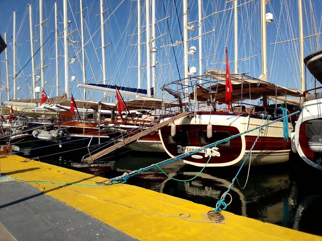
Today I visited Bodrum, just a half hour minibus ride from Bitez into the centre of the town. The main attraction for me was St Peter’s Castle which houses the very impressive Museum of underwater archaeology. Bodrum sits on top of the ancient Carian city of Halicarnassus, very little of which remains. King Mausolos had a massive tomb built, one of the seven wonders of the ancient world, and from which we get the word mausoleum. The city’s fleet of gulets dominated the eastern Mediterranean and today the quay is still lined with beautiful modern day versions, ready for a season of chartering.
PS, I popped my head into a traditional Hamam Turkish bath / sauna / scrub / massage, just out of interest. I beat a hasty retreat as the owner, who looked like a body builder, tried to persuade me to give it a go. !
Gulets
Saturday 13th April
Departed Bitez anchorage yesterday mid morning as a light breeze started to fill in. When I had looked out earlier I thought there was fog which seemed very odd. It turned out to be smoke smothering the bay, from a forest fire up in the hills. It has been an unusually dry winter in the Aegean and on Leros they were very worried about running out of water this summer. If the ground is tinder dry in April it doesn’t bode well for fires again this summer. So I continued journeying east along the northern coast of the Gokova Korfezi gulf. Many boats were coming and going out of Bodrum. By midday the wind had increased to its usual strength, now blowing up the gulf from just south of west, so I was again on a broad reach and bowling along at 5 to 6 knots. I was looking for a sheltered bay for the night and came upon Alakisla Buku. A deserted spot, with a small island in the centre of the bay upon which was a metal sculpture.
My next stop was to be Gokova Oren Marina, another 15 miles further along the coast. Here I just wanted to use their black water pump out facility as it’s now 10 days since I received the blue card. By all accounts if you are checked by the coast guard they look for a stamp at least every 14 days. The wind slowly filled in from west as the day proceeded, reaching 14 kts as I arrived in Oren bay. The marina said the pump station was available so I headed straight onto the dock. It took less than a minute to empty the holding tank and after a little confusion with the guy I was given a piece of paper to confirm the operation, for a fee of 360TL (£9). A bonus was that he let me fill the water tanks too, something he was not meant to do as the marina require you to stay a night for that. I then anchored just outside, in the bay, and as the depths increased rapidly, I had to drop the hook less than 100m off the beach. It was very busy with holidaymakers but the swimming buoys are not yet deployed, nevertheless not an ideal position.
PS, the flies around here, which look like our innocent house flies, are a particularly aggressive cousin, with teeth !
Alakisla Buku, with sculpture
Monday 15th April
Yesterday morning I departed Oren on the early morning land breeze blowing out of the gulf. As usual though it didn’t last long before the late morning calm. I was heading further east again with a view to stopping perhaps for a short while in Akbuk Limani bay. However just as I reached there a nice F3/4 wind filled in from west and seemed too good to waste, so I pressed on to the intended night anchorage near the head of the gulf. Here the mountains on the north side are high, and drop steeply to the sea, generating particularly intense katabatic gusts if the wind is from north, as was the forecast for the night. Gelibolu Buku is on the south side of the gulf as it narrows toward the head. It is wide and and has a river flowing into it, creating a large delta with many tributaries. I anchored in the SE corner in 9m, on a bottom of mud.
Daytime temperatures now are over 30c and the midday sun very strong. So this morning I launched the kayak early and paddled up one of the branches of the river, more a creek really. It is very shallow at the point it reaches the sea, just deep enough for the kayak. Then you enter a world of mud banks lined with tall reeds and bullrushes, the channel meanders this way and that. Herons fly overhead and fresh water turtles, about the size of a tortoise, plop into the river from their sun bathing spots on the muddy bank. I was able to go about a mile upstream when the banks closed in and fallen branches blocked the way, before returning to the bay via a different route.
Wednesday 17th April
Yesterday moved a very short distance around the corner to Sehir Adalari (Snake and Castle Islands) . Surely one of the finest places I’ve visited in the Mediterranean. It is the site of the ancient port of Kedreai in late Bronze Age and later occupied by Romans. Apart from the amazing ruins, including a small theatre currently being excavated, it is the site of Cleopatra’s beach. The legend has it that Anthony installed her on the island and had galleys bring sand over from Egypt to create the beach for her. To this day the beach remains and analysis of the sand indeed confirms that it is from North Africa and nothing like local sand. In summer this is a magnate for tourists but today I arrived early and there was not one other visitor. There are a half dozen staff in the day, and a night watchman living on the island, as they are hugely protective of the sand. Notices warn of dire consequences for anyone caught removing any.
This morning I moved on a little further to the bay at Sogut. The route meandered around islands and headlands, craggy limestone cliffs rising above thickly wooded slopes leading down to crystal clear water. Really great scenery. I was first tipped off about Sogut bay by a Turkish couple I met in Hammamet, who claimed it is one of the most sheltered places in the whole of Turkey. Locals winter their boats here on moorings and some visitors even on anchor. The wind today was forecast for 25kt + gusts from SE so it seemed an ideal time to test the claim. I knew the exact spot I wanted to moor as Duncan had spent 6 weeks here last summer. It is in the SE corner backed by tall pines but is tricky as the depths drop off quickly and I would need to get shore lines deployed. It took two attempts to get enough chain out and backed in close enough to get a 50m line around a tree, with still enough depth under the stern gear. All while dealing with a cross wind ! It has proven 90% sheltered but a few fairly hefty gusts have crept around.
Cleopatra’s beach
Friday 19th April
Yesterday morning I reset the anchor as the wind was going around to west and over the last 24 hours SO had already moved back toward shore by half a boat length and was too close for comfort. I reset with 55m chain and extended the lines by 20m so am now about 70m off the shore.
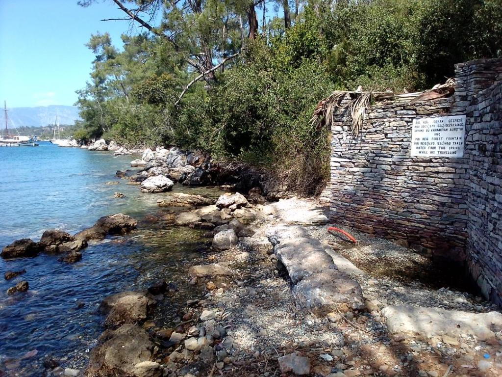
The village of Karacasogut has three long jetties, all crammed with sailboats, all Turkish, as only locals are permitted to long stay here. There are three mini markets with fairly limited supplies but enough to get by, and a couple of cafes. The rest of the place consists of mainly modern smart homes interspersed with small holdings that market garden on the fertile plane up the valley. Like other places I’ve been there is much activity preparing for the impending summer season to begin. I took a walk along the shore behind me, through the woods, and came across a natural spring with a stone construction around it, and a sign saying it is the very place where one Piri Reis drank from on his travels. He was an admiral in the Ottoman navy and produced some of the earliest known maps of the New World. Look him up here https://en.m.wikipedia.org/wiki/Piri_Reis.
This part of Turkey is very heavily wooded with pines. The valleys are fertile with an abundance of small holdings and fields of healthy looking crops. The hills/mountains are steep and craggy, nevertheless new roads have been forged through them joining the villages to major towns like Marmaris. From KarakaSogut I caught the Dolman (public minibus) into Marmaris, a half hour ride. The bus looked brand new, you pay by tapping your credit card, and the route and stop names are displayed on a screen by the driver. It’s all impressively modern, efficient and convenient. I have yet to see in Turkey, in the countryside or the towns, a single dilapidated building, anyone living rough, any sign of social deprivation. The whole place looks like it has been built in the last 20 years. Everywhere life seems to be thriving. It’s quite remarkable and a big contrast to all the other places I’ve been in the Mediterranean. Perhaps I’m just seeing the best part of Turkey, the most prosperous.
The natural spring
Sunday 21st April
In the early hours of yesterday morning tremendous thunderstorms swept across the bay. Biblical quantities of rain pounded the decks for hours. There were 6 inches of water in the dinghy in the morning. But the most extraordinary outcome was that I detected not a single drop of water that had penetrated the cabin, from any hatch or window. The first time in all the years I’ve had SO, thanks to sikaflex !
In the afternoon it cleared up and I paddled over to my neighbour for a chat. He is a local Turk now retired and lives on his boat almost year round. The boat looks like a local fishing caique but is in fact from the Black Sea where he had it commissioned in the ‘90s, when he worked in Russia. It is built of chestnut. He also brought home his Russian wife. Whilst we talked he was baiting a fishing line with bread, the line had 500 hooks, one every meter, and he carefully arranged each one around the edge of a basket. He also attached very small floats every few meters and the whole task would take him all afternoon to prepare. He would be going out the following evening to cast the line in a great circle and put a light on it. He would then leave it till morning to recover. This has been the traditional way of fishing for hundreds of years. He reckoned on average he might catch about 20 fish and would sell them to the local restaurant.
Today I continued a little further west along the south side of the gulf, to Degirmen Buku, or English Harbour as commonly known. It is so named because in 1944 the SBS successfully hid, with its eastern Aegean fleet of local boats, in this particular branch off the bay. It is well hidden, a large pool completely surrounded by forest covered hills, providing 360 degree shelter and invisible from the gulf. Not surprising therefore that President Erdogan has now adopted the bay and built his summer retreat here. When in residence, access to the whole bay is closed to the public.
Thursday 25th April
On Monday I left English Harbour to sail further west around Koyun headland and then south past Yedi Adalari, which translates as Seven Islands. I skirted around the end of the southernmost one into Gokagac Koyu. It is a deserted region with no human life on land or sea, just noisy colonies of seabirds nesting on the islands. Litter on the beaches is however abundant, brought by wind and currents. Mostly the usual plastic and polystyrene, the usual odd shoes and sandals (why never a pair ?), and this beach even had a resident fridge, which I assume floated because of all the foam insulation.
The next leg was to take me back west all the way to the southern entrance of the gulf. I waited a day for strong southerlies to calm down a bit and on Wednesday, with forecast 15 to 20kts offshore, set off for a fast passage. I shot out of the bay under foresail alone at 7kts but soon the wind decreased so I put up the main with 2 reefs, just to be cautious. Boy was I glad of that because a little later I was in a maelstrom, 36kt gusts cascading off the mountains. I wound the genoa in to the third spot and wrestled with the helm to keep us on track while bearing away in the worst gusts. The whole boat was shaking as we roared along at 8kts, without surfing, I feared for something breaking somewhere. This lasted a couple of hours before moderating to 25kts, which seemed like a gentle pootle in comparison. The final few miles was close hauled into a bay on the north side, and a mile from the tip, of the Knidos peninsular, 35 miles covered in 6 hours.
This morning I sailed around the corner into the ancient harbour of Knidos. I saw more boats in the hour it took than in the previous 2 weeks combined, as the headland is on the main route between the south and west coasts of Turkey. It was also on the ancient trade routes to the Middle East and Egypt so little wonder that a major port grew up as far back as Mycaenean times. It is also blessed with two harbours, one facing east and one west. The east harbour is where visitors anchor today and provides great shelter in anything but an easterly. The extensive remains of multiple civilisations rise up the slopes on both sides, pretty much just as they have disintegrated over millennia, not systematically excavated and not presented in any way for the tourist. It must have been a wondrous sight in its heyday.

Knidos
Saturday 27th April
Yesterday left Knidos for what I expected to be an easy downwind sail eastward. I should have known better by now, the wind was anything but the forecast 10kts or so from NW. Again the wind was coming over the high hills / low mountains (up to 500m) but this time instead of acting to accelerate the wind, they caused a wind shadow, and at times light wind from the opposite direction ! I called in at the harbour of Palamut where one report on Navily had said there was a black water pump. I was sceptical but didn’t want to miss an opportunity as its now 13 days since the last. It is a quiet backwater and just minutes after entering, a guy came running down to the quay clearly pleased to have a visitor. He was then disappointed to have to tell me there is no black water pump but that I could try the next place, Datca. And with that he had the good humour to wish me a nice day.
Datca is a popular tourist town, with two bays one either side of a rocky spit and a small harbour in the south bay, where I anchored. There was one other boat anchored, British flagged and only the second one I’ve seen out and about. They dinghied over later to say hello and enquired if I was getting recurring DSC distress calls. I had been from when I was a couple of miles out and apparently it had been going on for a few days. So annoying it was, that they had had to leave the VHF turned off. The MMSI is registered to a Chinese fishing boat apparently, located in the South China Sea. My guess is someone near Datca has bought a PLB or similar on eBay and it’s gone off unknowingly. Or perhaps it’s another Chinese government attempt to destabilise the West. Btw I heard on the news last week that Russia has been interrupting GPS signals in the Aegean, affecting aircraft in particular. It’s a sobering thought when I think how reliant I’ve become on the chart plotter and iPad Navionics.
Anyway I’ve been able to restock the larder here and when I asked the harbour master if I could have a black water pump out, he said not to bother coming in and promptly gave me a receipt to say it’s been done, in exchange for 200TL, cash. Now that’s what I call service !

Yet another Attaturk statue !
Wednesday 1st May
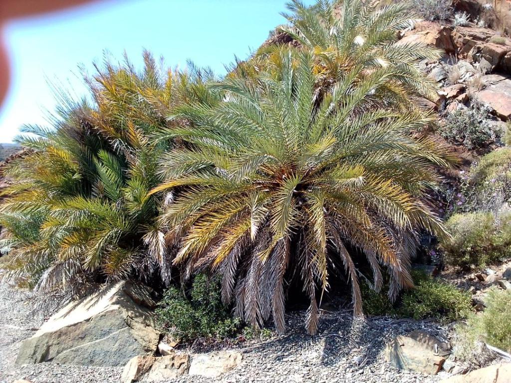
On Sunday I continued eastward along the north side of the gulf of Korfezi. The meltimi continues to blow hard from NW as I leave Datca, making 6kts under a half furled headsail only. There are any number of potential anchorages along this coast but most are open to SW and the swell tends to bend around into them. I had two in mind, the first, Armak Buku, just 13 miles along, looked fine with minimal swell. It was deep water till within 100m of the beach, when I dropped the hook in 15m. I planned to either take a shoreline or the kedge onto the beach but when I paddled over I found there were no rocks suitable to attach a line, nor anything for the kedge to dig into, as the beach was composed of slippery pebbles. The trees here are unusual and you can be fined for securing to them. They are Cretan date palms, rarely found anywhere outside of Crete.
On Monday I travelled further into the gulf again. I’m now on the hunt for water as only probably a couple of days left. Navionics indicates there may be a tap at a campsite in Bencik Limani, a narrow inlet which stretches a mile inland and almost cuts the peninsular off to make it an island. In fact when the locals were threatened with attack by the Persians in ancient times, they set about digging a canal but gave up as the rock proved too hard to cut through. When I arrived in the pool close to the campsite it was soon apparent that the place had been abandoned so after a short sorte I turned back down the channel. The next stop was Kuyulu Buku, an isolated bay close to the head of the gulf.
On Tuesday it was a short sail across the head of the gulf into Keci Buku. In search of water I called in to Marti Marina and went to the fuel dock. I topped up with diesel as although I’m still on three quarters full, it is much cheaper here than in Greece. I then asked if I could get water from the tap just close by, but was flatly refused. You have to take a berth for the night, for a fee of around £100 ! So I carried on to the head of the bay and anchored. Around the shore are three small jetties belonging to restaurants. I took the water container and the first one I tried was happy for me to fill it. I did this twice in fact and emptied into the tank, so now I have at least 6 days worth, based on 10lt / day. It does make you value water.
Today the meltimi has moderated so it was a good opportunity to start heading west out of the gulf. The Greek island of Simi lies in the middle of the gulf so boats are carefully staying the correct side of the red line on the chart, depending on whether they are traversing from one Greek island to another, or the Turkish coast. I beat up to within a few hundred meters before tacking. As I approached the coast near Datca the wind built to 20kts, by this time I had the second reef in and the genoa well rolled. However just 2nm south of Datca, in Kargi Koyu bay the wind had all but vanished as I dropped the hook.
Cretan date palms
An old 12m America’s Cup boat.
Sunday 5th May
The past few days I’ve been slowly making my way back northward, slowly because the winds are persistently northerly meltimi. I’ve been making the most of light variable winds in the mornings and seeking refuge by early afternoon when a F6/7 starts to set in. On Thursday I managed to make enough progress, with some wind assisted motoring for a while, to reach the bay at Palamut. Not the most sheltered but good holding.
On Friday, the one day when the wind was from W, I planned a big push north across both the Gokova Korfezi gulf and the Gulluk Korfezi gulf. It was an ambitious 50nm but doable if the winds held up. An early start gave me a fine beat around the Knidos peninsular, where the morning rush hour was in full swing. Everyone else was in a rush, motoring hard in both directions, the sad truth of chartering with limited time. As I commenced crossing the first gulf, a splendid F4 on the beam propelled me north toward the eastern end of Kos. In theory it requires a big dogleg around the island to avoid Greek waters but I noticed that the few other boats that were making the same passage, my way and the opposite way, were ignoring this and cutting straight across. So I did likewise, turning off the AIS so my position was not being broadcast, and sailed to within half a mile of the island. It was then a short beat NW to round the Pasa Rock on the northern corner of the gulf. It was just 3pm when I reached this point, and the remaining 25 miles were still doable. But then the wind slowly died and backed to SW, speed dropped away to 4 then 3kts as I passed Gumusluk. I would have stopped there for the night but knew that if I did I would be pinned down there for the following 2 days. However if I could make it around the next corner there would be a number of potential anchorages a short way along, and positioned so that further progress could be made in short steps across Gulluk Korfezi. I ended up in Turkbuku Bay, which used to be called Rumbuku, Rum being the Turkish name for Byzantines or Greeks. The name was changed in the 1920s when the mass exchange of Greek and Turkish populations took place. Today it is a favourite spot for Turkey’s jet-set, the anchorage is populated with huge motor yachts while the hillsides are lined with villas. In the evening the shoreline restaurants and night clubs came to life, the music booming out over the water into the early hours. Needless to say not my sort of anchorage!
An early exit yesterday provided a fast broad reach just 12nm north to Kazikli Iskelesi. Under foresail alone we sped between the myriad of fish farms. This bay is a shallow lagoon, littered with moorings many of which are used by the vessels servicing the fish farms, but still ample room to drop the hook, and excellent shelter. I visited the one restaurant here to ask for a fill of the water can. The kind owner was not only more than happy to oblige but gave me a cup of tea and even offered to tow me and the dinghy back to SO when he realised I was under oars and would have to battle upwind.
Fish farms
Tuesday 7th May
On Sunday I spent the day at anchor in the lagoon at Kazikli Iskelesi, sitting out 30kt gusts. So much for it supposedly being sheltered ! I was watching a group of noisy terns, either Arctic or Common I think. They are so acrobatic in the wind, they fly about 50 ft over the water with their head down and then suddenly twist and dive when they see a fish. It seems an impossible task to catch one as they don’t dive under like gannets do, but they seem to be successful at catching small sardine sized ones. In between fishing they have bouts of sparring, briefly hovering and facing off to each other.
On Monday it was a short and furious close reach over to Didim in 20kts , anchoring in the bay outside the marina, as I had done when I arrived in Turkey.
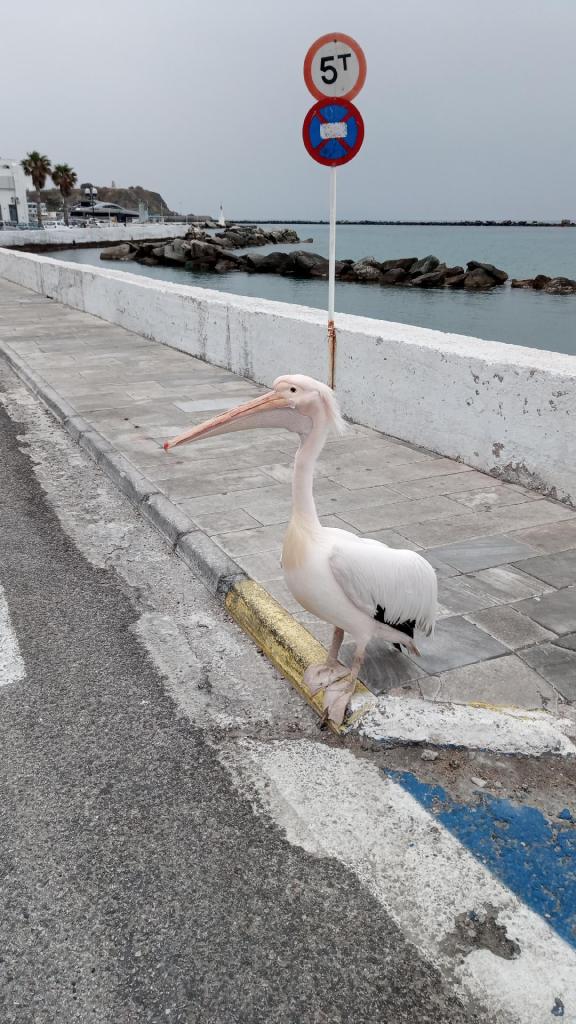
Today has been one of the best sails this year. It was a one tack beat for 18 miles, in a F3 over flat water. SO purred along at 5kts. Along the way I saw flocks of pelicans that were loitering next to fish farms, hoping to catch the occasional escapee perhaps, or at least enjoying the smell of fish. There were also some black swans and some dolphins that were leaping a full body length out of the water.
The final part of the passage involved passing between the Greek island of Samos and the Turkish coast. This narrow channel, just a mile across, is the closest point the two countries meet over water. There is a Turkish Coastguard vessel permanently stationed in the middle, presumably to intercept migrant boat crossings, although perhaps some swim across.
Saturday 11th May
On Wednesday I sailed to the town of Kusadasi, my last stop in Turkey. It is a major tourist centre and cruise ship destination, which makes it a Port of Entry and therefore a place that I can clear out. After a night anchored just outside the harbour on Thursday I went round to the marina to dock for a couple of hours whilst I engaged their agent to handle the clearing out process. This involved me riding pillion on the agent’s scooter as we shuttled from police to customs to immigration etc. To have the passport stamped we had to go to the cruise ship terminal where we bypassed the queues of hundreds of folks from the four ships in port that day, to get to passport control.
Then it was off back to Greece, and specifically to Varthi on the island of Samos, 12 miles distant. It was another day of vanishingly little wind, but I was able to squeeze 3kts of speed out of 4kts of wind, sailing just slightly free on close hauled. I backed onto the quay, next to the one other boat, in acres of space. Then we started the process of clearing in, almost another two hours, visiting the Police, Customs and Coastguard.
On Friday I left Varthi as the bay on which it stands at the head, faces NW, the direction of the meltimi. It is known to be untenable in strong conditions, which is exactly the forecast for the weekend. I sailed around the eastern end of Samos and back into the narrow straight between the island and Turkey, anchoring at Posidonion, in a bay facing my anchorage in Turkey just a few days earlier. Unlike Turkey the summer season has not yet started here, the one shop in the village was closed, and at the one cafe/bar, they were not expecting a delivery of ice creams until the end of the month !
Today I moved on to the town of Pythagorio, renamed as such in honour of Pythagoras who was born on Samos in 5th century BC. I have come into the small marina, the first in 6 weeks, partly because it is the most secure place while the winds blow through, but also a chance to fill the water tanks, do laundry, and explore this ancient town. One of many great building projects here, from the middle Bronze Age, is the tunnel carved through the mountain behind the town, to bring water from the middle of the island. A mile long and 8ft high it was dug starting from each end, and the two teams of diggers met exactly together, such was the skill of the architect.
Leaving Turkey
Tuesday 14th May
Yesterday I departed the marina at Pythagorion, having enjoyed a safe harbour from the 35kt winds over the weekend. It was still a fresh 20kts as I romped west, across the bay to cape Kiriacov, on a broad reach. Then I headed to the island of Fournoi about 20nm distant, the southern tip was on a perfect heading to lay on a very close reach. The anchorage there was also as good a passage anchorage as you could possibly hope for. Lying directly on route for Mykonos, and providing excellent shelter in a deep bay facing due south, there was solid grip for the anchor on a pure sandy bottom. The only sign of life was a small fishing boat that came in late evening and left again early morning.
Today was an epic 54nm in just 9 hours, from Fournoi to Mykonos. I passed the western tip of Ikaria where plan B was to stop if progress was too slow. Far from it though, for most of the time it was a beam reach in a F4/5 and we were doing up to 7kts with two reefs and the genoa rolled to the second spot. We even touched 8kts at times surfing. This journey took me from the eastern Sporades group of islands, due west, to the Cyclades group. It crosses the main route for shipping travelling north/south but I encountered just one ship, and only one other boat, sailing the opposite way to me. There is a noticeable change in weather, I’ve left behind almost constant blue skies and sun for 6 weeks, and come to a region with heavy dark clouds. There is also a noticeable decline in seabirds, one feature of the Turkish coast was the much greater number of birds than I’ve seen elsewhere in the Mediterranean. Perhaps they are managing better fish stocks. Tonight I’m anchored in Frangias Bay, on the western side of Mykonos.
Blue Street, Pythagorion
Friday 17th May
Yesterday the plan had been to visit Delos, a small island just off the coast of Mykonos and one of the most sacred places of Ancient Greece. Yesterday the forecast was looking settled but during the night it changed, and by first light the wind was gusting 28kts, and it seems to be localised to Mykonos. So I decided to move on to Tinos and brave the heavy weather for a couple of hours as I leave the island. In the channel between Mykonos and Delos the wind funnelled as expected, so I was prepared by being fully reefed before I stuck my nose out. It was then a hard slog for an hour before reaching open water and the wind started to moderate. Another hour later and it was down to single figures, such is the variability and localisation of winds in the Aegean, and half an hour later again, as I approached Tinos town, I faced 28kn gusts, inside the outer breakwater ! I was wondering how backing onto the quay was going to work out, but by the time I reached it, all was peace and tranquility again. €10 for the night and just 100m to the supermarket, make this a great a stop over.
Tinos is famous for its marble, used for statues in classical times, and kitchen worktops more recently. Also a lot of it was used to build the Panagia Evangelistria, a Greek Orthodox Church, that is a major site of pilgrimage. It was built where an icon was discovered in 1823, one that had supposedly been buried 850 years earlier. In the crypt where the icon now resides, it is wall to wall gold and silver decoration. The street running down the hill from the church to the quayside, is full of shops selling votive offerings and icons to the pilgrims. The economy of Tinos is built on firm ground in more ways than one !
Today as I set off for Andros, the next island north, it looked like being another day of variable strength and direction of winds, and the only certainty being it anything other than the forecast. It turned out to be very favourable, and I was able to make it to the town of Batsi, a distance of 32nm, in just 6 hours. Many ferries race up and down this stretch of water creating such a wake that most of the bays are untenable as anchorages.
The bad news though is I now have a blocked toilet outlet hose that is going to require complete removal from the bowels of the boat, if you’ll excuse the pun.
Tuesday 21st May
On Saturday I left the bay on Andros heading north again, to the southern end of Evia. I would have stayed a day on Andros if it were not for the fact that the winds are very favourable just now, and for the next few days. I will be passing this way again in September all being well. With a F4/5 on the beam and flat water we tore across the bay past Gavrion, where I had to negotiate one ferry coming out and another in. Then I cleared the northern end of the island and came to the 15nm gap over to Evia. This is a notoriously rough stretch of water as the meltimi funnels between the mountains on each island. Today was not so bad but F6 became F7, just an aft the beam, so the main and genoa were reefed right down and we still hurtled along at 7 to 8 kts. There is a lot of shipping through this channel but I got lucky and easily fell into gaps in traffic both ways. As I came into the lee of Evia I expected the wind to either die or become gusty katabatic, but instead it came round to SW and continued to push me at pace on the opposite broad reach. I passed through the very narrow channel between Evia and a small island called Nisos Xero, by now on a run with just the main to slow down. The anchorage for the night was just around on the NW side of this island, a remarkably peaceful spot with not a breath of wind deafening silence.
On Sunday, as I departed the anchorage, it was a flat calm and seemed not to be the best time to set sail but if there is one thing I’ve come to learn about this region, it is to expect the unexpected. Wind soon came from a variety of directions before settling into its normal pattern of easterly and building to F5 during the afternoon. So it was another splendid broad reach at over 6 kts which brought us quickly to the next stop at the small village of Voufalo at the head of a narrow inlet. The small bay was pretty full of boats at anchor but I found just enough space which happened to be adjacent to where Duncan and Dianne are anchored.
Friday 24th May
On Wednesday it was just a mile or so to the marina at Chalkis, however there was no space there and I was directed to go to the town wall, clearly marked by a thick red line along the edge of the quay. It was just out of the current which races past reaching 6 to 7 knots at springs, through the narrow gap under the old bridge. There is also up to a half meter tidal range, something not to be ignored as depths along some parts of the quay are less than 2 meters. I was allowed to stay on the quay just long enough to go to the nearby office to book and pay for transiting the bridge later. At this time of year the bridge opens Monday, Wednesday and Friday, just the once and in the night. This is because it is a busy road joining the two halves of Chalkis town. I was told to listen on ch12 from 9.30pm and wait till I was called to go through. In the mean time I had to anchor in a bay opposite the quay. I did however get a chance to nip to the chandlers to buy a new length of toilet outlet hose, which was duly fitted without too much trouble. Later D&D arrived and checked in and he was told that we would likely go through at about 3am ! By early evening there were 10 boats waiting in the anchorage. Everything was readied for making a quick exit when called, then I got a couple of hours sleep. At 2.45 am the Port Authority came over the airwaves and started the roll call for boats to weigh anchor and stand by, I was fourth in line. We were then called individually to pass through, all very orderly, and the timing coincided with slack water. Apparently some times it is not like that, people don’t wait and it’s a bun fight, and there is video of one boat getting caught in a fast current and swept down onto the bridge before it’s opened. Not a pretty sight. We decided to go onto the quay on the other side after passing, as the anchorages further on were all exposed to a strong NW wind coming by the morning. Before closing the hatch and getting some more sleep we had to secure anything left on deck as sadly the place has a bad reputation for thieves.
Next day was spent on the quay and then we moved on around the corner to a quiet anchorage for the night. Temperatures are back over 30c so a cool swim was in order.
Yesterday we set off further up the gulf bound for the boatyard near Limani which is where SO will be lifted for the summer. It was the usual pattern of winds, light an variable all morning so a mixture of tacking and motoring, then F5 on the beam in the afternoon. The boatyard is situated behind a narrow stony beach in a wide bay and seems the most unlikely place. When we arrived it was blowing nearly 20 kts along the beach. It’s too deep to anchor but the yard have three mooring buoys for waiting on for lift out. We did a reccy around the yard and arranged to meet the owner early next morning. They launch and recover using a trailer on long extension arms, quite basic but judging from how full the yard is clearly effective, and usually it’s done in mornings and evenings when usually very calm. We shall see in about a months time.
Chalkis anchorage and quay, south side, with the bridge just round to the left
Tuesday 28th May
Saturday we sailed off our moorings and headed northwest toward the NW tip of Evia. Winds as usual were light and variable but we managed to clock up a few miles before the late morning calm. Early afternoon the wind finally picked up from NE giving a broad reach for the final few miles to the corner. Here there were strong currents in the narrow channel between the sandy spit off Evia and some small islands. We came round on to a beat into a F5 gusting 6 headwind. The then followed 4 hours of hard tacking up the wide channel between the north coast of Evia and the mainland. The wind would shift through anything up to 50 degrees and it became an interesting match between our two boats. After a lot of winch grinding we came to Vathikelou bay on the mainland side. An almost totally enclosed lagoon, very sheltered from all winds but deep in most places so anchoring was tricky, particularly as the bottom is largely weed. Later the anchor did drag a bit and I had to reset. Behind the narrow strip of beach were a number of dwellings, which looked like only used in summer. There was the usual collection of barking dogs so someone must have been resident and feeding them.
Sunday was little wind so we stayed put. On Monday the forecast was favourable for some of the time for carrying on NE, destination Skiathos in mind. Initially wind was west of north so we managed a long tack to almost clear the NE corner of Evia. But then it veered more and more and became a frustrating 6 to 7 kts on the nose, too little to make any real progress and too much for comfortable motoring. So I switched between a bit of both as the wind varied. By late afternoon, when the wind died for the day, Duncan was 3 miles ahead and another 4 off Skiathos town, so he carried on while I diverted to the anchorage at Koukounaries. Not a great spot initially as the bay was busy with all manner of toys, the most annoying being the doughnuts doing loops around the few boats at anchor. By 6pm though they all packed up and peace descended.
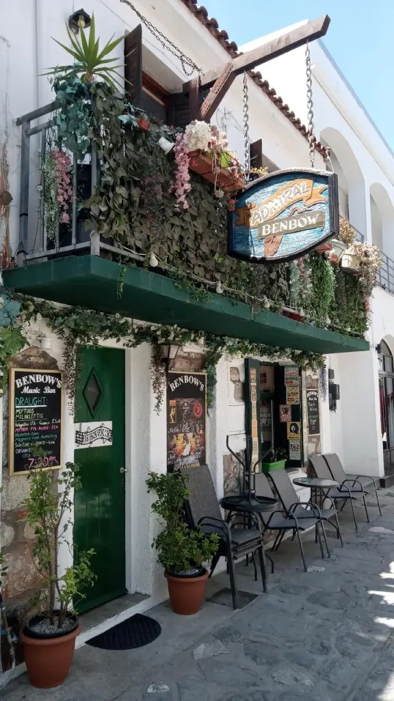
Today I caught the light early morning breeze to take me around to Skiathos town quay, which was busy but a couple of spaces had come free by 11am. The day has been spent capitalising on the facilities, water, rubbish, laundry and food re-stocking. This afternoon a strong breeze from SE kicked up a fair old chop in the harbour. I pulled a couple of meters off the quay as the boats heaved and snatched on their lines. The place is wall to wall bars and restaurants, we found a sort of English pub, the Admiral Benbow, which seemed an appropriate watering hole given the connection with Shrewsbury.
Friday 31st May
On Wednesday, after devising a plan to meet up with D&D in a few days time, somewhere on the Halkidiki peninsular, I departed the quay at Skiathos bound for the neighbouring island of Skopolos. In a light breeze close hauled I crossed the channel between the two islands, and continued around the southern tip to Stafylos bay for a lunch stop. There is a big charter boat base in Skiathos so many boats are transiting this route. Later I continued on around to the eastern side and Skopolos town bay to anchor for the night. The town is very attractive with its narrow winding streets climbing the hillside, brightly painted houses with adorned with flowering creepers, and literally dozens of ancient tiny churches. It has a long quay behind the breakwater which can accommodate a few tens of boats.
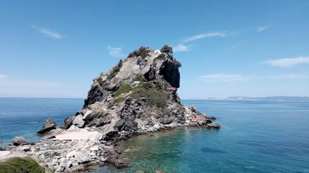
Skopolos is famous as the filming location for Mamma Mia so the next day I set off for the rocky peninsular with the little chapel on top. It’s a big tourist attraction but late afternoon most had left and I was able to anchor right under the headland.
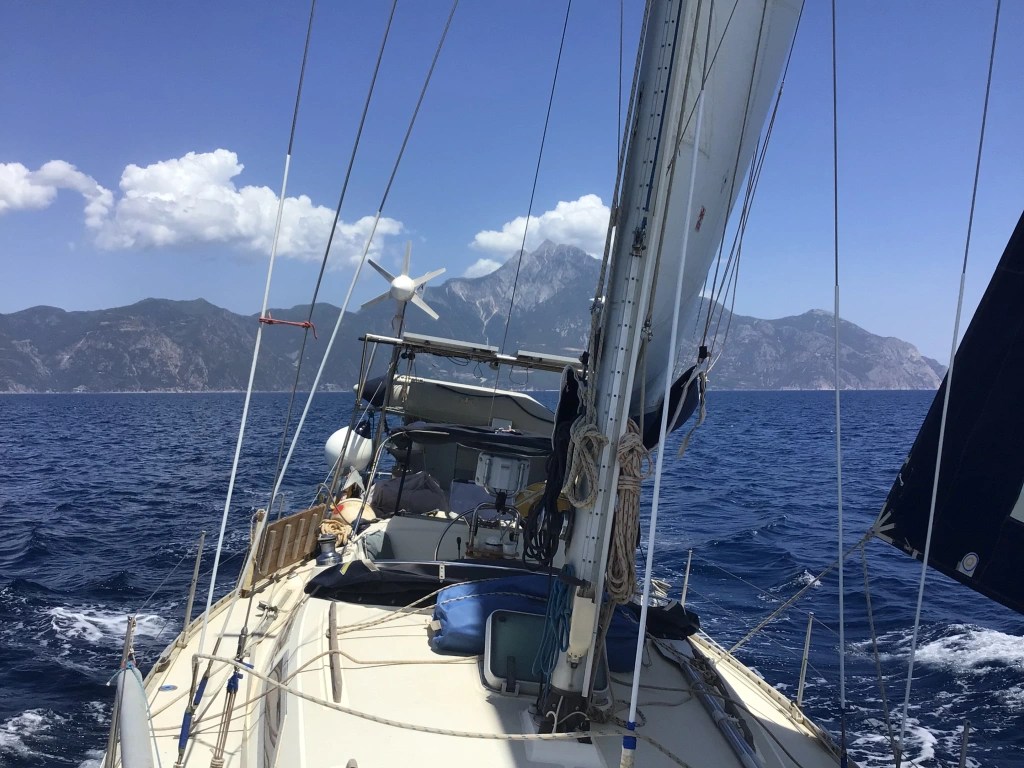
Today I set off at sunrise for the 45 mile passage, almost due north, to Nea Skioni on the left of the three fingers of Halkidiki peninsular. The forecast was the usual light breeze from W in the morning then calm then strong breeze from SE from mid afternoon. This turned out to be accurate. Just one ship passed, heading for Thessalonika, and a very large fish, perhaps a tuna, leapt a good meter out of the water in front of me. I could see the towering Mount Athos on my right, a distant 60nm ! (Looking forward to getting close to that), Mount Olympus to my left, and in between, an open expanse of water, the only one in the island crowded Aegean. I arrived at Nea Skioni at 6pm, with D&D just a mile behind, and moored stern to on the south quay where there were just a couple of spaces amongst the fishing boats.
Mamma Mia church, Skopolos
Friday 7th June
Since arriving in Nea Skioni the pace has somewhat slowed, for a variety of reasons. Firstly the town itself, a traditional small family resort in early season, frequented by a few older couples and young families. It’s quiet and laid back, not frantic like Mykonos, with a fine sandy beach and beautifully clear water. In the harbour there is room for just half a dozen visiting boats on the quay, as well as us English we’ve got French, German and Dutch and all soon bonding. And it’s free ! The town has all the essentials with a butcher, baker, fishmonger and supermarket. Dianne bought a whole fish directly from one of the small trawlers so we’ve been working our way through that for three days. Of particular interest to me was that Tim Severin and his replica Greek galley, the Argo, called in here when recreating the Jason and the Argonauts search for the Golden Fleece. A second reason for staying here is that there is literally no wind and it’s over 20 miles to any next possible stop.
However on Tuesday, while Duncan waits for delivery of some spares to fix his water pump, I decided to move on, especially when I noticed cobwebs forming between the vhf aerial and wind speed indicator, that has not rotated in 4 days ! In a very light breeze from SW I headed east to the Sithonia peninsular, the middle finger, around the end, and into the Singitikos gulf. I anchored on the south side of Sykia bay looking across at the towering mount Athos. This gulf is about 25nm long and 12nm wide, line with thick pine forests, and some of the best sandy beaches in Greece, most backed by a camp site. On the Sithonia side there are many anchorages in the sandy bays, and near the head of the gulf are the Diaporos islands. On Wednesday I set off for these, beating into a steady 10/11 kts over flat water, superb sailing, SO so well balanced she could sail a steady course herself. This was just as well as in recent weeks the autopilot has been intermittently failing, and now more frequently. It’s the same problem as exactly five years ago in Lagos, the rudder feedback sensor is failing and I will not be able to get a new part from Garmin until back in UK.
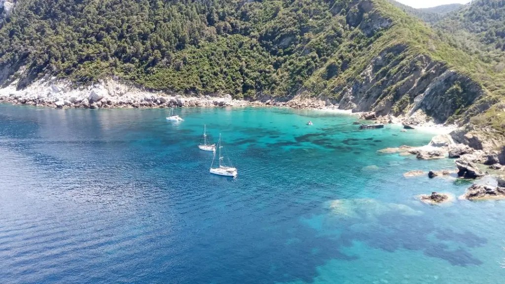
The Diaporos islands are reminiscent of the Scillies, low lying with shallow sandy lagoons in between, they are made of pink granite that has been shaped by wind and sea into huge rounded lumps. The beaches are the cleanest I’ve seen in Greece and protected from all directions, it is a fine place to stay anchored for a few days.
Diaporos Islands
Friday 14th June
Tuesday. After an extended stay on Diaporos island, where frankly one could easily stay for ever, I weighed anchor before it was permanently embedded in the sea floor. The wind patterns in this area, at the northern end of the gulf, are so incredibly stable we have had almost exactly the same every day for over a week, and remain so for at least another four days. I drifted out of the bay and northward through the narrow channel between the island and mainland. On reaching open water I had 10kts on a close reach and decided that instead of spending a night in the ‘blue lagoon’ on the NE side of the island, I would continue across the gulf, given the perfect sailing conditions. It was just 8 miles across to Ammouliani island, close under the third finger, the Akti peninsular. I anchored in Glastri bay, where King Charles and President Bush have apparently both anchored in the past. No sign of them or indeed anyone at all today.
Ouranoupolis is a town on the peninsular just 2 miles across from the island. It’s where all the trip boats leave taking people on tours along the coast to see the monasteries. I walked from the town a mile or so to the end of the track which terminates at the border with this semi autonomous region. A high fence and big signs make it clear that entry will result in severe penalties.
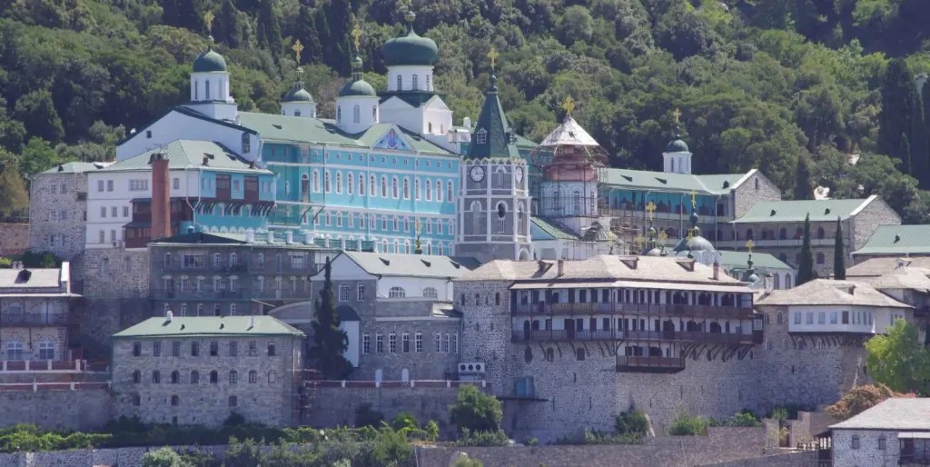
Today we finally had the right conditions to sail down the coast keeping the required minimum distance of 500m offshore. There are nine monasteries altogether on the western side of the peninsular, and another eight on the eastern side. Most date from the 11th and 12th centuries, some down by the waterside and others high up on the flanks of Mount Athos, perched on impossible rocky bluffs. It’s hard to choose which to share but here are a few, the one with green domes is the Russian Orthodox.
Wednesday 19th June
On Sunday D&D were up with the lark to leave the anchorage at Sikias at 0500, eastbound for Turkey. Soon after I also departed, heading south and west on the start of my return to Evia and the boatyard to leave SO for the summer. It also marked the beginning of the long return journey for SO back to UK over the next couple of years. The day was a mixture of light winds from E and periods of no wind as I made my way to the island of Panagia in the Sporades National Marine Park. At times the sea was a sheet of shimmering blue glass, the edges merging seamlessly with the sky. The surface was broken at times by shoals of fish, a couple of turtles, and a pod of a dozen dolphins, heading purposely across my path, presumably in pursuit of a shoal, and too preoccupied to stop and play for a while. In the Park there are restrictions on boats, where you can and cannot go, how close to shore, where you can anchor, and you need a permit which I obtained online. It does mean that there are very few boats and you have the benefit of a natural environment, untouched by development of any sort. Panagia is only inhabited by wild goats.
Monday. As often happens in remote bays late last evening a small fishing boat came in after laying a net somewhere nearby, and anchored till dawn when he went back out to recover the net. Clearly some limited fishing is allowed in this reserve intended to protect monk seals as well as rare birds and reptiles. I sailed on along the SE coast of Alonnisos, with a pit stop at Patitiri for essential supplies. Then on again out of the Park zone and over to Skopelos to anchor in Stafilo bay for the night.
Tuesday saw a long passage of 40nm from Skopolos west to the mainland then down the Trikeri channel and on into the Oren channel. Fortunately the wind has now started to pick up as a Meltimi returns to the eastern part of the Aegean. With a following wind I was able to run goose winged much of the time, and completed the passage in just 8 hours. I pulled into the very sheltered Vathikelon bay for the night, where we had anchored for a couple of days a few weeks ago.
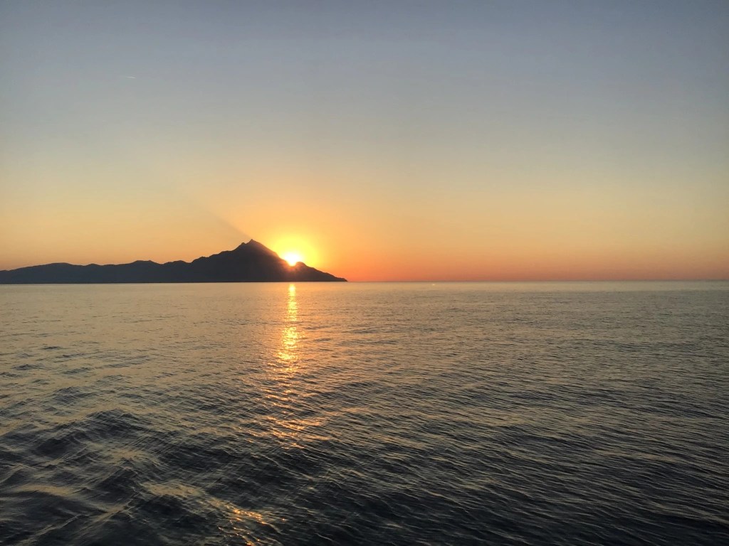
Here are a couple of Mount Athos pics, the second one taken at dawn.
Monday 24th June
This is the last post until September when I hope to return and continue the journey around the Aegean. I arrived on the mooring at Evia Boatyard near Limni, on the island of Evia, last Thursday. This was ahead of some strong winds forecast for Friday. Charis the owner suggested hauling out that evening when it would be calm, in case Friday would not be possible, bearing in mind this is an open beach. So at about 8pm the operation began. It involves him backing a trailer on very long extension arms into the sea, I then drive the boat onto the forward supports and a rope is picked up by the keel to align the stern above the aft supports. He then dives with snorkel to lift the stern supports and check all is in place before hauling the trailer out. Low and behold we emerge from the sea perfectly supported and upright. It’s all very ‘agricultural’ but the simplicity is its key to success, a method they have been using for over 20 years, and they can even handle catamarans.
It’s as well that I came out early as day time temperatures have been mid 30s and the sun immensely strong, making it difficult to do much from mid morning to late afternoon. The hull has been cleaned, rust spots on the keel ground out, and patches primed, ready for antifoul when I return. The hull anode wire brushed and looks good for another year, the prop anode removed and needs replacing, and the prop itself sanded smooth. All in all there has been very little fouling in this end of the Med.
The only issue once again has been the wretched Transit Log, which here in Limni the Coast Guard and Port Police both tell me I do not hand into them to stop the clock on my 6 months permitted aboard the boat. They’ve never heard of the rule, which caused the issue I had in Leros. The problem though is that the Log still indicates that I have until mid November, and there seems no way to stop the clock on that. They seem to make the rules up as they go along !
Thanks once again for following this blog. I look forward to resuming after the intense heat of summer in Greece has subsided.
Thursday 12th September
Arrived back at Evia boatyard on Sunday after a tedious 24 hours of travelling but was pleased to find Sea Orchid in fine fettle, if a little dusty. Spent the next day antifouling, fitting a new prop annode, and re-rigging, until late afternoon when Xaris transferred us back onto the trailer ready for an early launch in the morning. However the next day, as it turned out, the wind had gone onshore making launch through the surf impossible. Early afternoon and the wind had gone offshore so we were towed down to the beach, only to arrive just as a squall blew through so we postponed again. Finally at 6pm we entered the water and went onto the yard mooring for the night. The upside of all this delay was that I had all day to get the new Rudder Feedback Sensor installed, a tricky job that required precision placement next to the steering quadrant. It seems to be good so far and will eliminate the constant failing of the sensor inside the ram, which bedevilled me back in June.
On Wednesday it was hot, sunny but windless day as we motored south to Chalkida to pass through the bridge. However upon arrival I discovered that the bridge does not open on Wednesdays, schoolboy error ! So I went to the quiet bay just north of the town to anchor for the night. I returned to the quay today and checked in for the bridge opening, then visited Barbouris marine chandlers to procure some fibreglass resin to permanently bond the rudder sensor into the hull, now that I know it’s working well. Also did a couple of supermarket runs to restock the larder. Bridge opening was anticipated to be about 0100 hrs, when the current is slack, but I was pleasantly surprised when they called us up to pass through at 2300 hrs. There was a good 4kt current against us going through so had to punch it at full revs. Anchored for the night in the bay just to the south of the bridge.
all tarted up and ready to go again
Tuesday 17th September
On Friday I had 45 miles to cover to make the rendezvous with Brian and Jennie flying into Athens. The last 10 miles turned into a slog into 18 kts on the nose in a lumpy sea, conditions that SO makes very heavy weather of. The second of two possible pickup points turned out to be perfect, Ormos Vraonas, a narrow inlet well sheltered, with a short pier nearby, and just a 20 minute taxi from the airport. Saturday we headed of south, close hauled on a fine breeze from SE. A stop was made at Varthi Avlaki bay on the NE side of Makronisos island. It was very crowded with a mix of boats from big power cruisers to small day boats all vying for a space to drop their hook. It provided entertainment while we lunched and had a dip. Then it was a reach across to Nisos Kea and the town quay of Livadhi. Arriving soon after 1600 hrs there were still a few places on the quay, but it took four attempts at reversing in before getting it right ! We spent two nights here, the first was a bit bumpy as the westerly wind brought a sea into the bay and curled around. Livadhi was a typical small Cycladic harbour, and popular with Athenians for a weekend break.
Yesterday we motor sailed down the west coast of Kea and around the southern tip to visit the archaeological site at Karthaia. There is a good anchorage in Polaris bay and the remains of three 5th century BC Doric temples are on a rocky promontory between two beaches. Then we continued on to the island of Kythnos and a fabulous bay at Potamia on the NE side near Loutra. We had the bay to ourselves for the night, with a full moon rising over a flat calm and total silence.
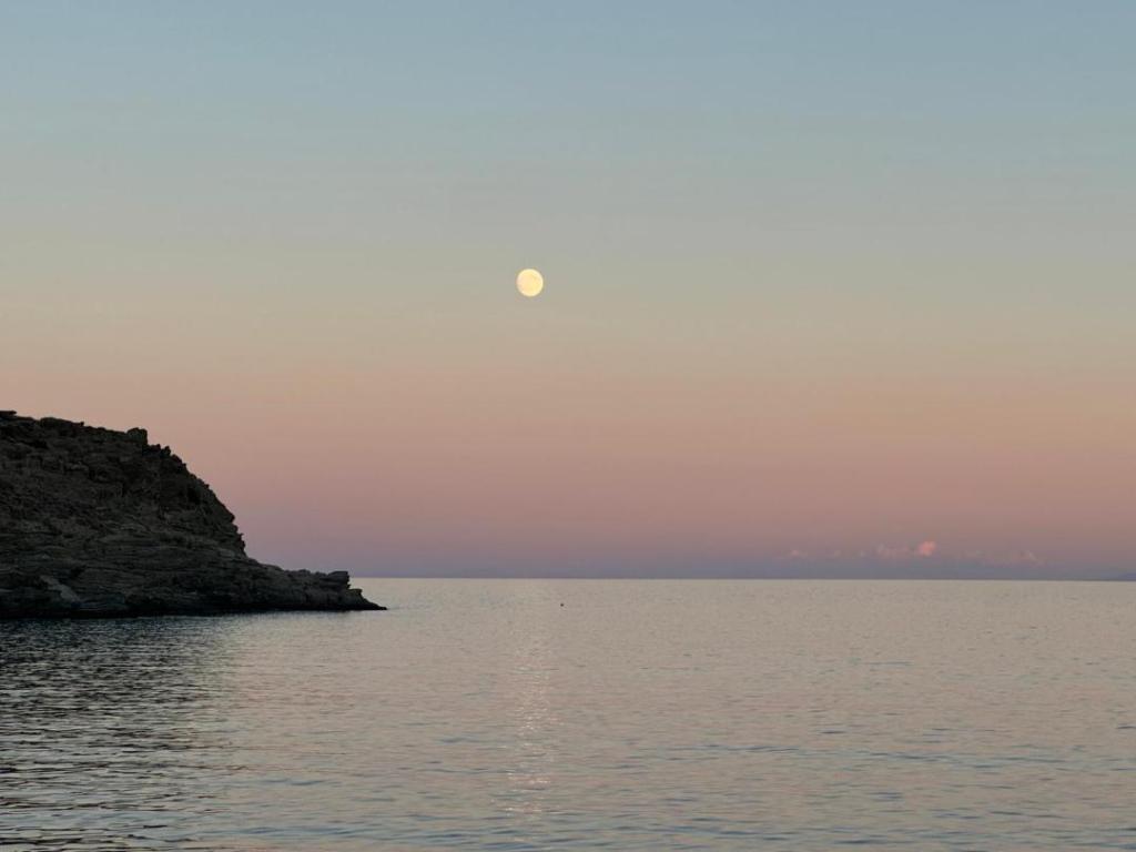
Saturday 21st September
On Tuesday, in a very light easterly, we motor sailed south to the island of Serifos and the port of Livaldi. We anchored in the bay just around the corner from the harbour, though finding sand amongst the Posidonia proved challenging and it took two attempts to get the hook to hold. We took the bus to the Chora, just a couple of miles away but up a very steep climb to where it clings to a precipitous rocky outcrop looming over the port.
Wednesday was another windless day so we reluctantly had to motor again, south to Mylos, 24nm distant. Conditions were good to visit the white pumice rocks at Sarakiniko beach, before carrying on into the caldera to anchor off the port of Adamas. Whilst there a variety of vessels came into the bay, small cruise ships, very large sailing yachts, and bizarrely a fleet of seven small superyachts that all arrived at once.
The following day Brian hired a car and we toured the island, visiting the remains of the Bronze Age city of Klima, standing above the present fishing village, and where the famous statue of Aphrodite was found. Yesterday we went over to the pontoon to fill up with water, and I then restocked the larder while B&J visited the town of Plaka, before leaving for their flight back to Athens late afternoon. As ever, they have both been great shipmates for their short time aboard.
Today I set off at 0530 hrs for the 75nm passage west to the south eastern tip of the Peleponesis. Wind was already a northerly F5 as I beat out of the caldera, and I just managed to clear the western corner of the entrance in one tack. As I bore away SW and cleared the island, I met a frenzied sea which lasted all day. There was a big swell from east combined with a short cross sea from north, resulting in random steep breaking waves. Keeping the boat on a steady course needed constant pre-emptive corrections of the helm, something the autopilot is hopeless at. On the upside though I was belting along at over, and at times over 8 as the wind gusted F6, so the miles rapidly fell away. The last 10 miles I was crossing the major shipping route from the western Med to the Black Sea and had to avoid 6 potential hazards according to AIS. One ship actually made a change in course, which doesn’t often happen, usually I have to take the initiative. I reached the sheltered waters of the Elafonisos channel at 1700 hrs and anchored in the splendid sandy Sarakiniko bay on the south side of the island, just as thunderstorm clouds were gathering to the north.
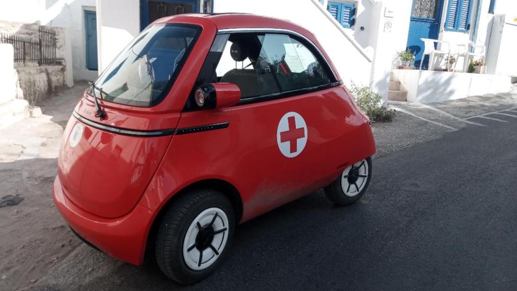
Emergency response vehicle on Serifos
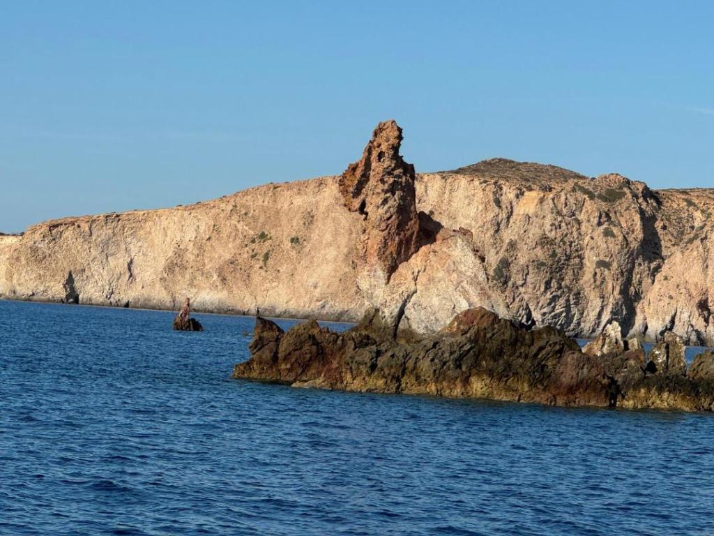
can you see a rabbit in this photo ?
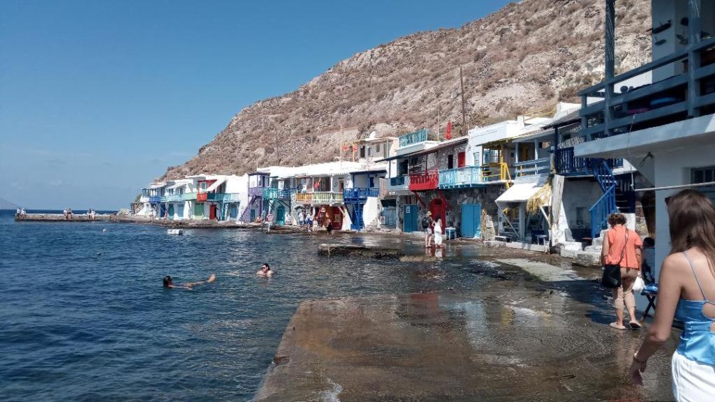
the fishing village of Klima, the ground floors are boat houses, but with global warming will soon have indoor swimming pools instead.
Wednesday 25th September
Nisos Elafonisos means deer island (so not what you might first think). Below is a photo taken from the Pilot book of the Sarakiniko anchorage, the water is crystal clear. On Sunday I had the larger of the two bays all to myself, an indication of how the season is now winding down. On Monday I headed around the island and north to explore the Gulf of Lakonikos. Almost exactly a year ago I was sailing in the opposite direction having skipped around the Gulf on a mission to get to Leros while weather was good. In just a few knots of breeze SO skimmed over the flat water on a close reach and after a few hours arrived at Arkhangelsk about 16nm distant. It is a traditional village with just a few local small boats and a couple of visiting campervans. An enormous sign gives comprehensive details about the Blue Flag status of the beach, and the penalties for doing anything to harm this reputation. I’m afraid though that I did make use of the shower close by. On Tuesday it was another fine day with just a few knots of wind from west as I crossed the Gulf to the town of Githion, not seeing another boat all day. I anchored in the same spot as I had last year, just outside the harbour which is full of fishing boats, tour boats and various abandoned boats. The town has been important since Mycenaean times, it saw the rise and fall of Sparta and became the most important town of the Maniotes, the fearsome and independent people of the Mani Peninsular. Today it is a congenial place full of cafes and gelato bars. Today I sailed south, down the eastern side of the Mani peninsular, in a light southerly wind. By short tacking close inshore I was able to capitalise on the wind bending around headlands and into bays. No boats seen again until we arrived late afternoon in the remote anchorage at Porto Kayio close to the tip of the peninsular. Winds can often be fearsome here with severe katabatic gusts off the high and steep hills that surround the bay. On my approach I had a taste of it and it took two attempts to get the anchor to grip, but tonight the wind is dying away and there is not a sound.
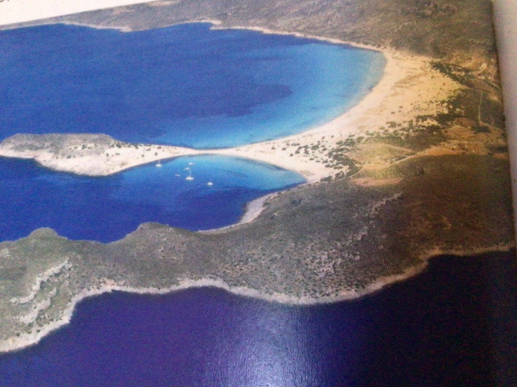
Sarakiniko bay, Elafonisos, taken from the photo in the Pilot book.
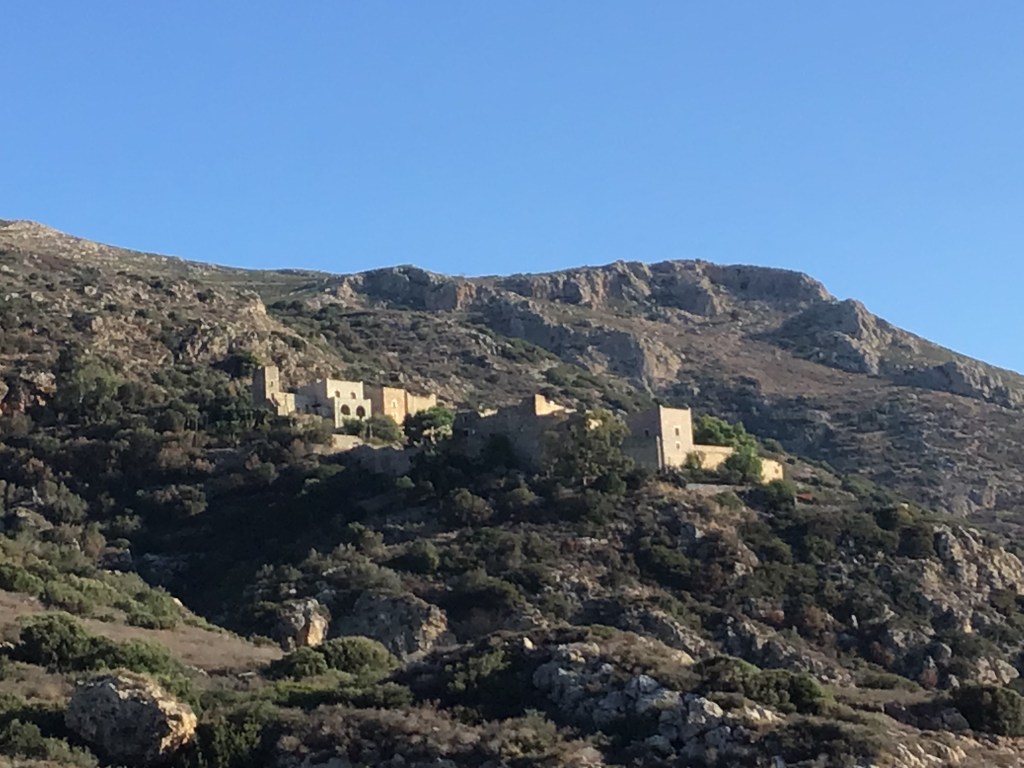
traditional Mani homes were built as strongholds
Sunday 29th September
On Thursday I rounded Ak Tainaron, the tip of the Mani peninsular. The forecast wind of up to 10kts from NW didn’t materialise so had to motor around in very lumpy water. On the way up the western side of the peninsular I finally caught a light NW breeze for a while, but the further north I went the further round to south the wind backed and there was not enough pressure to keep wind in the sails. I passed Capo Grosso with it’s 800ft sheer cliffs, and upon which seabirds were notably absent. I pulled into Ormos Diros and anchored off the beach. It’s not the ideal place when there is a swell rolling in from west so I laid out a kedge to keep the bow pointing into it. I wanted to stop here to see the famous Diros caves, an extensive complex of limestone eroded tunnels and caverns.
On Friday I did the guided tour in a boat like a punt, but due to high water levels they had to limit its scope. The stalactites and stalagmites are over 1 million years old and quantities of hippopotamus bones have been found amongst Stone Age tools in parts of the complex that are now underwater but were once dry when sea levels were much lower. I then continued north with just enough wind to sail as the water now is much flatter. I headed to a small bay, called Glyfa on Navily but unnamed on charts, a couple of miles west of Kalamitsi. Totally inaccessible by land and big enough for just one boat, I took a shore line to rocks at the head of the narrow inlet.
Saturday there was good snorkelling around the rocks of the bay, seeing a great variety of fish and coming alarmingly close to a type of moray eel hiding in a crevice. When a few days trip boats started appearing I cleared out and had a gentle sail across the head of the Gulf, to the small town of Petalidi. Here there is a bay sheltered from all directions but particularly West from where strong winds are forecast for the next two days. There are half a dozen boats anchored here, one of them is a British flagged Moody 38, so I have been over this morning to say hello. The poor chap said he has scabies and suggested I might not want to come aboard so we talked at the stern while I stayed in the dinghy !
Moray eel… take my word for it
Wednesday 9th October
So after a week or so loitering at Petalidi, visiting some local sights such as the amazing ancient Messini, Chris and Beth arrived as planned on Sunday. We topped up with fuel and water, acquired an extra gas bottle, and did a big shop at Lidl in Kalamata. Food has been squirreled away all over the boat, wherever there was a small space. In a brisk 20kts we sailed on a dead run down to Koroni on Monday and anchored in the bay south of the castle. Then on Tuesday in very light airs went around the cape Akritas, stopped in Tsapi bay for lunch and swim, and sailed on to Methoni for our last night, and last supper in Greece. The Ottoman castle looked resplendent lit up at night and again at dawn in the rising sun, when we departed the anchorage. Next stop Malta all being well, on Saturday.
Tuesday 15th October
We arrived in Malta on Saturday, just as the light was fading. It had been a fairly uneventful crossing all in all, though the previous 24 hours had been challenging. After leaving Methoni the day unfolded much as forecast with light variable winds. Sometimes enough to make 3 to 4 kts but more often not, and we motor sailed. It allowed us to gently settled into out routine of a watch system, the 24 hour cycle of steer, eat, sleep, repeat. The next two days were a mixture of light variable winds, sometimes on the nose, and a good F4 mostly at night when we put in most of the miles in the right direction. Halfway was reached Thursday night. Friday the wind started to increase and the sea built with it. By sunset we had both reefs in the main and the genoa rolled to the second spot, and still bowling along at 5 or 6 kts. Despite the full moon which lasted half the night, steering became ever more difficult in the confused seas, the scale of which became apparent at dawn. A flying fish had stranded itself on the deck, a beautiful blue and silver. On Saturday while the wind slowly subsided, it took much longer for the seas to follow suit. In a bid to maintain an eta before dark we motored the last 30nm. Landfall was maaround 1500hrs and was just preceded by a great number of ships all anchored on the eastern side of Malta up to 16nm offshore. The only sheltered anchorage attainable before dark was the commercial harbour at the south eastern end of the island. In just 3m of water we dropped the hook in the north eastern corner. Given the industrial surroundings it was a surprisingly peaceful night, though I think we all could have slept through pretty much anything anyway.
Sunday we went into Valletta harbour where we seemed to be going the wrong way up a one way street as hoards of boats were pouring out for the day. We berthed at Rodney’s Marina which turned out to be perfect for our simple needs, a shower and a hearty meal. The following morning I went to the Port Police to get my passport stamped for EU exit and then we sailed on to the small island of Comino and anchored under the cliffs close to the Blue Lagoon. It was pretty manic with tour boats zooming around until early evening when all but one other boat left. The tall cliffs loomed over us as we gazed up at the night sky and Beth spotted the comet trail in the west. Tuesday we crossed the narrow channel to Gozo and berthed in the marina at Mgarr.
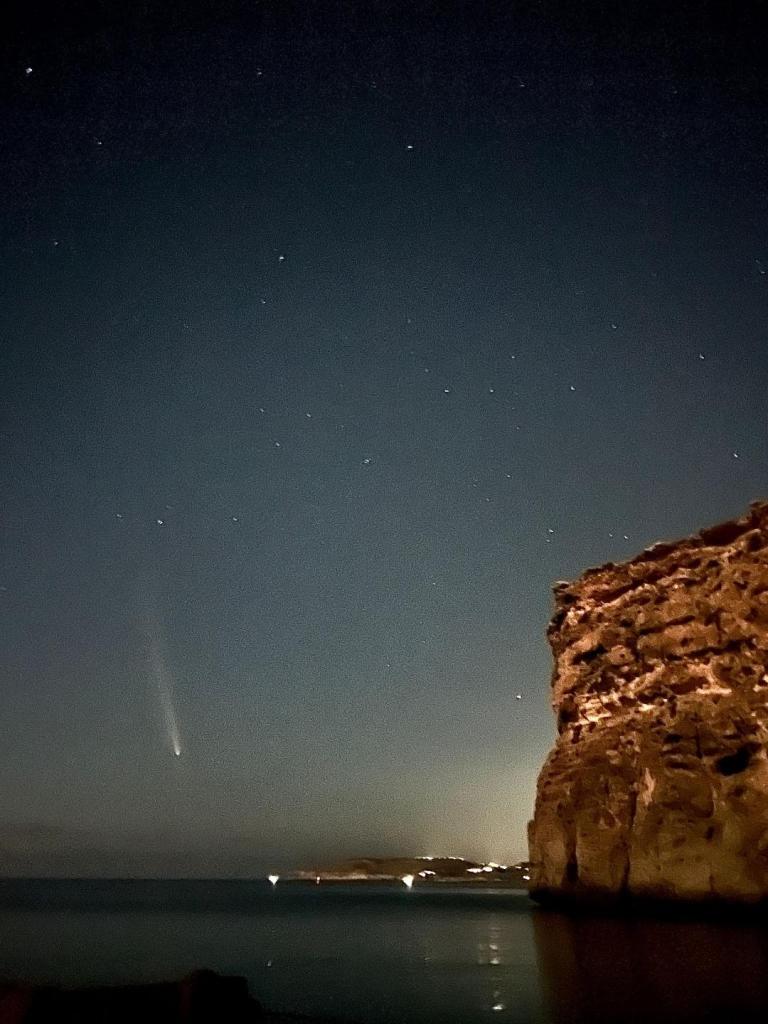
Saturday 19th October
On Wednesday at 0700 hrs I left Chris and Beth standing on the pontoon with their bags, to catch the fast cat ferry back to Valletta. (Postscript, on the way to their Airbnb later that morning Beth slipped and broke her ankle !). After a slow start, by midday I was bowling along on a broad reach, bound for Tunisia. I passed an enormous turtle, it’s head the size of a pickup buoy. By evening the sea was becoming rough as the wind increased to F5. Before dark I put one reef in the main and rolled up some genoa. While doing this I discovered a tear in the luff of the main close to the foot. It was a very bouncy night and dawn revealed a confused sea, however progress was good with an average speed of nearly 6kts. By early afternoon of the second day I was dealing with a F6 wind from SE and a big sea building, as I hurtled toward Hammamet. The entrance to the marina faces south, has a depth of just 5m and is only 100m from the beach. I was increasingly concerned that entry might be untenable, with the likelihood of steep breaking waves. I had already been pooped by one wave that broke over the stern cabin. There is nowhere else to go for at least 50 miles in any direction so if this were the case there would be no option other than to stand out to sea through the night till conditions improved. I approached cautiously and timed the final run in to the entrance to coincide with a gap following the biggest of the swells. I ran dead down wind at maximum speed under engine, before making a hand break turn to starboard as soon as I passed the outer breakwater, and bursting into the serene waters of the outer harbour.
Thus the final adventure of this season has ended. Sea Orchid will spend the winter afloat here in Port Yasmine while I attend to a growing list of maintenance jobs.